
| Date | 7/22/2023 |
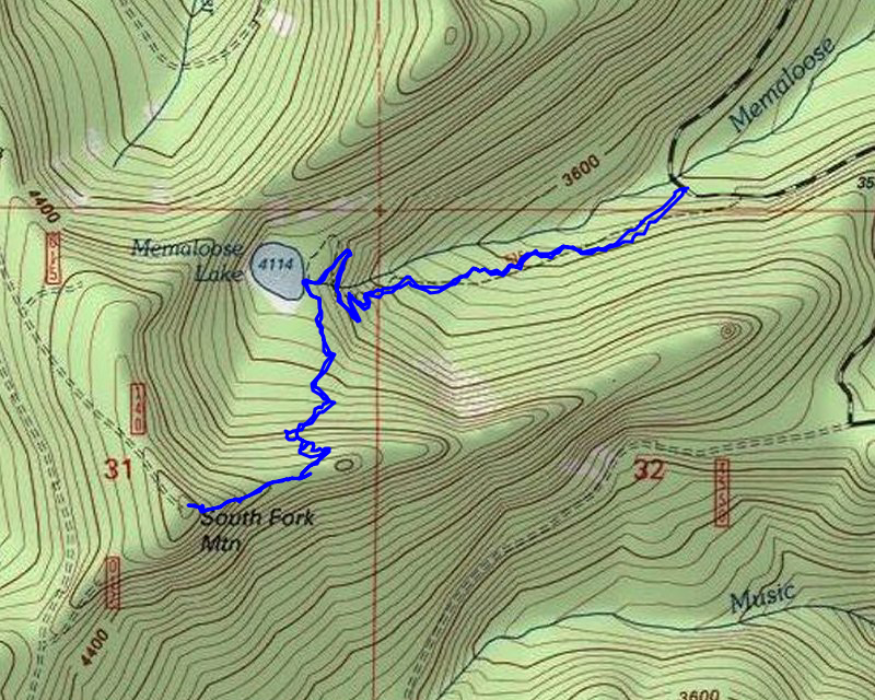
| Location / Trail | Memaloose Lake and South Fork Mtn - 515 |
| Weather | Sunny |
| Hiking Buddies | Abby and Thor |
| Start / End | 10:40 AM – 2:20 PM |
| Distance / Elev | 4.2 miles 1450 ft elevation |
We headed out about our usual time and got to the trailhead a bit after 10:

While the area at the trailhead did not look like it burned, you could see burned areas nearby – this was looking north from the trailhead:

We saw another truck at the trailhead, which surprised me. We leashed up Thor since we weren’t sure what we’d encounter and then headed up the trail. The beginning of the trail is mostly as I remember it, with maybe a bit more brush than last time. That does not surprise me since this trail has been inaccessible for 3 years now. The only people on it have been FS employees who did some work on it during the closure.
As we made our way up the trail, you could start to see the beginning of the burn – looked like mostly a ground fire:

As we headed up it got worse:

Part way up the hill, we ran into the owner of the other truck – it was Eric! He had been doing trail maintenance on this trail for the last couple of weeks – some significant tread work! We talked for a bit and then continued our trip up the hill. We soon got to the upper creek crossing which looked a lot different than I remember:

This is a picture of it from 2014 – this was earlier in the season so it was flowing a lot faster but you can see it was in the shade – today it was all in the sun:

As we progressed up the hill, the burn seemed to be getting more severe. As we came to the last switchback before the lake – the burn got quite a bit worse – it burned really hot in here:

This is what Memaloose creek below the lake looked like:

And this is just about the same area from a trip in 2014 – again the water was running a lot faster but it looks significantly different:

We soon got to the lake:

The campsites that I remember were effectively gone. This is what this same general areas looked like in 2014:

Somewhere in here used to be a campsite:

This is what the campsite at the lake looked like in 2019:

We stopped here for a bit and I asked Abby if she wanted to continue up to South Fork Mountain – this is what the trail looked like in that direction:

Eric had flagged a route thru that big mess which wasn’t too bad and she was a trooper and decided to head up. We got thru the big mess and soon started getting out of the burn area:

For a short while we were back in the forest that I remembered – big trees with lush undergrowth. That didn’t last too long – we started getting closer to the ridge up to South Fork Mountain and the fire had crept downhill from the ridge which had dumped a bunch of small branches on the tread – this is what this area looked like:

This is what around the same area looked like in 2017 – nice clear tread:

It was at this point where the going was too much for Abby – it was mostly her shoes – she was slipping a lot on the loose ground. I asked if it was OK if I went up to the top and she said it was fine. I wasn’t really intending to go all the way up but once I got past a few logs and branches, things opened up quite a bit. Once I got up to the ridge, it was clear sailing:

We continued up the ridge and soon made it to the top of South Fork Mountain:

We looked around a bit and took some photos of the mountains – first there was Jefferson and Olallie:

Next was Hood and Adams:

I didn’t want to spend too much time up there so I took the pictures pretty quickly and then headed down. I got back to Abby who had eaten lunch while I was gone. We worked our way back into the unburned area and then back into the burned area. When I talked with Eric earlier, he had said he found part of the “trail not maintained” sign. On the way up I had not seen it, but on the way back down I did find it:

This is what that sign looked like in 2019:

We got back to the lake and stopped again. I ate some lunch and then flew my drone to get some video of the burned area around the lake – the video is coming soon.
After that, we headed back down the trail and met Eric again and chatted a bit. He asked how far we got since he hadn’t made it up there yet. I told him there was some unclear areas but once on the ridge it was clear sailing since everything had been burnt up. After chatting a bit, we headed down and soon were back at the truck. Since it was still a bit early, I asked Abby if she wanted to go see Music Creek Falls and she said OK, so we headed up 45 to its junction with 4550. This road has gotten pretty brushed in over the last several years. We did make it, but it was pretty rough in a few spots.
Once at Music Creek falls we headed down the trail and soon saw the falls – they aren’t terribly impressive this time of year since there isn’t much water flowing, but I still think it is a neat waterfall. After seeing it, we headed back up and then I decided to continue on 4550 since I thought it might be better than going back the way we came. As we got to the junction with 4540, we headed back that way. As we were driving I asked if she wanted to try and go up to the top of South Fork Mountain. There is a road up there – I’ve never driven it, but thought it would be worth a try. She said yes, so we turned on the 4540-140 spur – it is actually in pretty good shape – it is somewhat steep, a bit rough, but not too brushy. We didn’t encounter any downed logs across it on the way up (which surprised me). We made it to the old lookout location, got out, took a few pictures and then headed back down.
From there out it was just a matter of driving home on a very familiar route (for me). It was a really nice day out with Abby and I’m hoping we can do this again.