
| Date | 11/16/2008 |
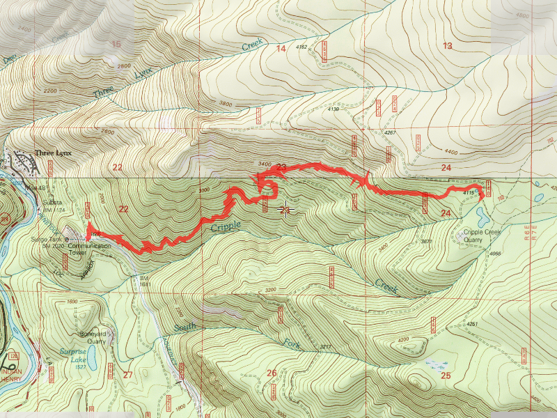
| Location / Trail | Cripple Creek Trail - 703 |
| Weather | Mostly Sunny |
| Hiking Buddies | Bodie (my dog) |
| Start / End | 8:45 AM – 12:45 PM |
| Distance / Elev | 8 |
The lower part of the trail is very well maintained, with a nice, even uphill grade. The trail is all uphill, but the grade makes it a pretty easy hike. Not too far after starting, there is a very pretty trailside spring/waterfall.

After about a mile, you come to a very interesting hillside meadow.

I’ve never seen anything like it before, but it looks like it might have been a rockslide that got covered with duff and eventually sprouted grass. The trail continues on, through some very pretty mixed age forest. Although I was not able to see the Cripple Creek, I certainly did hear it, and it sounded like it was running pretty high and fast.
After going through the first mixed age (virgin?) forest, you come to the first clearcut area. The dividing line was very noticeable, and one of the large trees looked like it had been used as a spar pole or something, as it had very definite cable gouges in it. you pass through this area, which goes between relatively young timber (20 years or less, I’d guess), and relatively open areas until you get to the 4635 road, which you cross and then continue to head up the hill.

This part of the trail gets a little rougher, with a some areas that would be tougher to navigate in the spring and summer due to the undergrowth. This time of year most of that had died, so it was easier to follow. There are also a few spots where the grade gets rather steep, however those areas are typically short.
One interesting note: After crossing the 4635 road, there was a couple of what looked like alder or vine maple sprouts that were hanging across the trail. I thought I’d trim them back – Well, I did, but they weren’t alder or vine maple sprouts. I’m not sure what they were, but they were very soft and lightweight. At first I thought it might be bamboo, but on closer inspection, it almost looked like balsa wood! Very light and easy to cut. I don’t know if balsa grows in these forests or not, or if there is a similar wood that grows here.
The trail crosses several roads, some still in use, and some that are old cat roads. For the most part, the trail is very easy to follow, however there are a couple of spots where you need to pay close attention. I had no trouble following the trail on the way up, however on the way back down, after crossing one of the roads, and passing a small camp (firepit), the trail went down a hill and I lost it. After a few minutes of looking around, I finally found the trail again. It did go down the hill, however it veered sharply left and a tree somewhat obscured the view of the trail, making it easy to miss. After that, I had no problems on the way back down.
All in all, a very nice trail that is well maintained. My favorite part of the trail was the lower section, since I enjoy the big trees and more mature forest. There were some nice old growth spots on the upper section of the trail as well, but they were smaller and fewer than down below.
The only negative of this trail is that this is quite a hill climb – About 2500′ vertical from west to east. The good part of that is the majority of the climb is well graded so it isn’t too difficult.