
Location of Hike: Bissell, Old Baldy, White Iris Trails
Trail Number: 502, 502-A
Weather during Hike: Rainy and cold
Start Time: 10:15 AM End Time: 5:45 PM
Hike Distance: 11 miles
To start with, the weather on this hike was pretty poor. It was raining a good part of the day and was rather cold (lower 40’s most of the day). We did see a couple of sunbreaks during part of the day, then the clouds would come back and it would start raining again. We persevered and stayed warm (mostly by keeping moving). We were ready to call it a day by then end, however. The rain had started to get to us.
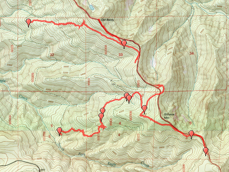
One little oddity with the GPS track above – not sure what happened, but the GPS shut off and I didn’t notice it for a while, so there is a gap in the track (about .6 miles or so).
While we did see some white iris in bloom, we did not see a sea of white iris which is what I was hoping for. I don’t know if it is because they just haven’t come up all the way yet, or if they don’t bloom all at once, or ???? But it was neat to see them in bloom, even if it was only a few of them. I’ve never seen a trail so peppered with one plant like this trail. If there ever is a time when they are in full bloom it would be a spectacular sight!

We successfully followed the Bissell trail from the trailhead – I got mis-directed at the start – there was a ribbon to the right which I mistakenly thought was the trail – the trail just takes straight off from the trailhead (old spur/skid road maybe?). This trail was easy to follow with the exception of one area with some blowdown and boggy areas where we briefly lost the trail, but found it quickly again. Other than that, it is in VERY good shape, and is easy to follow up to Old Baldy.
From the point where we met the Old Baldy trail, we headed NW up to Old Baldy. This trail is very purposeful, which means that it goes straight up and down hills – no switchbacks here! The last little push up to the top of Old Baldy (the site of the old lookout) is pretty steep, but we made it. Once at the top, we looked around a bit, but there wasn’t much to see since we were in the clouds (foggy) and the trees have all grown up.
Heading back down the trail, we passed the cutoff for the Bissell Trail, and were intending to find the actual cutoff to the White Iris trail, since I was unable to find it on my last hike due to snow. We were using the topo map as a guide for where the cutoff was, but it it WAY wrong. Fortunately, we kept hiking up the trail, and found the VERY apparent trail junction to White Iris. We kept going down Old Baldy until we got to the 504 Eagle Creek cutoff trail, but turned around there and came back to finish up the White Iris trail.
We were able to easily follow the White Iris trail to the junction with the 4614 road, and continue across until the base of a clearcut. At that point, there was a downed log, and the trail just seemed to disappear. We looked around, but found no tread after that point. We continued south for a bit and then headed west at another clearcut and landing, but all of this travel was cross country. No tread was found. After reviewing the map and our track, I’m wondering if the trail headed west about the point where that log was and we just were not looking in the right place for the tread. Another day of exploration is in order to find this last piece of missing trail……
The day wrapped up by having a traditional burger at Fearless Brewing in Estacada. A great way to fill an empty stomach from a day of hiking!!!! Especially when it is cold and rainy…..