
| Date | 7/7/2012 |
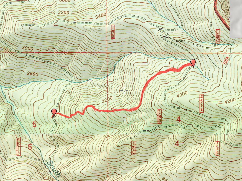
| Location / Trail | White Iris Trail - 502-A |
| Weather | Sunny |
| Hiking Buddies | Bodie (my dog) |
| Start / End | 10:15 AM – 1:00 PM |
| Distance / Elev | 2.6 miles |
What gives this trail its name:

It was a warm day and Bodie hadn’t been out for a while, so I decided to take him with me. I forgot any water for him, but he was able to drink from the stream. I also forgot his leash, but he did really well off leash. The first part of the trail was easy to follow – just like the last two times. We got to the clearcut, and the trail starts to get harder to follow, since the ground cover is really taking off. But, by paying close attention, you can see where the path is. Then we got to the BIG tree that had been uprooted. I took a hard right (westerly) turn, and looked around behind the rootball of the tree, and sure enough, there was the path going down hill.

It starts going downhill pretty steeply from this point, and there are sections where the path is not well evident, but by looking closely, I was able to follow the trail all the way down to the 4615 road. Once out on the 4615 road, I found that the GPS coordinates that I had to mark the lower trailhead were incorrect. They placed the trail about .2 mile south of where it actually was. That makes more sense why I had a hard time finding the trailhead!

After completing the hike, we had lunch at the trailhead and then drove all the way up to the end of the 4614 road – we tried to drive to the end of a spur road, but had to back up when there was trees across the road. It was also getting VERY narrow!
A short, but fun and very rewarding day.