
| Date | 7/28-7/31/2014 |
| Location / Trail | Enchantments Backpack Trip |
| Weather | Sunny and warm - blue skies all week! |
| Hiking Buddies | Carly, Kirk, Emily and Sarah |
| Distance / Elev | 20 miles |
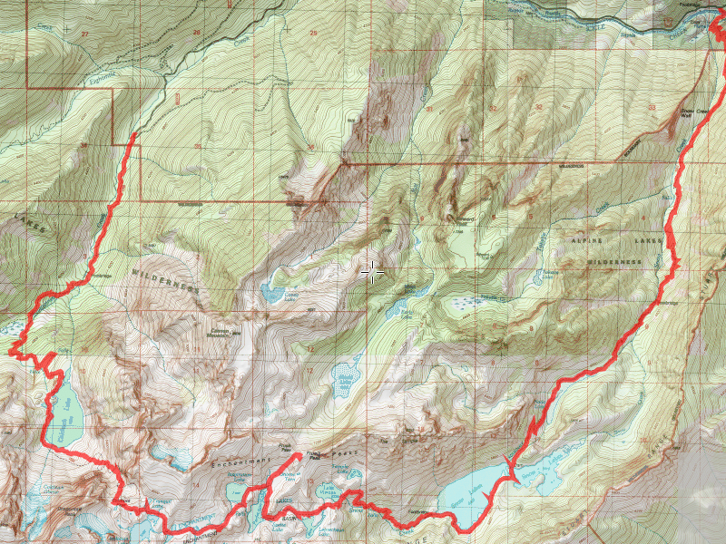
Once we had our permit secured, we then needed to plan our adventure. We were going to have two novice backpackers, and none of us are in outstanding shape, so we had to plan accordingly. We wanted to plan short enough days that were realistic in order to make sure we were able to complete the loop. The entire loop is about 18-19 miles, with LOTS of elevation gain and loss. Actually, doing it counter-clockwise like we did we ended up losing more elevation than we gained (the hike was a shuttle with the starting trailhead about 2000′ higher than the ending trailhead).
The plan was this:
- Day 1 – Stuart Creek trailhead to Colchuck lake – ~5 miles and > 2000′ of elevation
- Day 2 – Colchuck Lake to Leprechaun lake – ~5 miles and 2200′ of elevation (all of it in less than a mile – Aasgard pass)/li>
- Day 3 – Before packing up, backtrack to Prusik pass and out to Shield, Earle and Mesa Lakes, then pack up and head to Upper Snow Lake – ~6.5 miles and a loss of about 1500′ of elevation/li>
- Day 4 – Upper Snow Lake to Snow Creek Trailhead – ~6.5 miles and a loss of about 4000′ of elevation/li>
We deviated slightly from our planned itinerary – we didn’t go all the way to Leprechaun Lake on Tuesday – we stopped just past Sprite Lake which seemed like a good place to camp. We also didn’t go all the way down to Shield, Earle and Mesa lakes on Wednesday – we stopped at Prusik Pass and enjoyed the view.
OK, on to the report. We left home on Sunday afternoon, had our “last supper” in Leavenworth and camped near the trailhead at eightmile creek campground. We got up on Tuesday morning and left my truck at the lower trailhead and then drove the van up to the upper trailhead to start our adventure. We got to the the trailhead about 9:00 and were on our way before 9:30am, heading up the Stuart Lake trailhead.

We headed up the well groomed trail through relatively small timber until we got to the first crossing of Mountaineer Creek:

We continued on to our second crossing of Mountaineer Creek, which was quite different from the first:

We got to the junction of the Snow Lakes trail, and headed up towards Colchuck Lake. After a bit, we got our first glimpse of what was to come:

After climbing in the hot sun for what seemed like forever, we finally got our first view of Colchuck Lake, Dragontail Peak and Colchuck Peak:

We also got our first look at what would become rather annoying over the next couple of days – Mountain Goats:

Although that one was the only one we saw at Colchuck Lake, they would be constant companions once we entered the upper lakes basin. The weird part of them is that they crave salt, and want to lick up people’s pee to get the salt from it. It is really kind of gross, but that is what they do. They were not really aggressive, but they certainly were acclimated to humans and were not afraid of us.
We proceeded around Colchuck Lake, looking for a good campsite for the night. About halfway around, we found what we thought was a good place. It had nice access to the lake (a big rock was just under the water which made for great wading), and enough space for our three tents. It also allowed us to ponder our big challenge for the next day – Aasgard pass – 2200′ of elevation gain in .7 miles:

There was supposed to be a trail up that face, but we couldn’t see anything visible. It was going to be an interesting day on Tuesday. While we were pondering our fate on Tuesday, Kirk decided to go for a refreshing swim in Colchuck Lake:

We went to bed early with a plan to get an early start to try and beat the sun on the rocks up the pass. We woke up at 5:30 and were hiking by 7:15. We started around the lake and our first obstacle was the boulder field at the south end of the lake:

We worked our way through the boulder field(s), and finally got to the bottom of the ascent and started our journey up (it was even steeper than it looks):

We continued our climb, which kept getting steeper and steeper, and the “trail” getting more difficult to follow. They put rock cairns along the way, but it was still difficult to figure out where we were supposed to go. We got up right beside Dragontail Peak, and it had a whole new look to it, although it was still very impressive:

We got up a little higher and ran into a marmot, looking for food – he didn’t seem too interested or bothered by us:

We kept climbing, and climbing and climbing until we finally reached the pass – one last look down at Colchuck Lake:

We were now entering the upper lakes basin – the “good stuff”. All the alpine lakes and really interesting areas – along with the Mountain Goats.

Kind of a mix of moonscape, snow fields, lakes and strangely stunted trees. The scale of everything was way off. The rocks and peaks were HUGE and just popped out of the ground while all the vegetation was really tiny. Ground cover was sparse and short – trees – where there were any were gnarled and short.
After successfully summitting Aasgard Pass, we decided it was time to take a break for lunch. We were looking for some shady spot (it was getting really hot in the sun) and ended up stopping at Tranquil Lake, taking shade against some rocks. It wasn’t much shade, but it was the best we could find.

We also got our first real taste of the goats – Mama and her twins:

After we had lunch, used the “facilities” (there was a toilet on the other side of the lake), we headed down to the next lakes in the chain. Once you summit Aasgard pass, you are on essentially a downhill path – each lake feeds the lake(s) below it, so each lake is lower than the previous lake. When I was looking at the maps, I didn’t really realize this fact, since it is rather subtle. We made our way down to the next un-named lake:

We also got our first glimpse of mountain peaks that would remain with us for the next 2 days – Prusik Peak and McClellan Peak:

We continued across this barren plateau – There was still some snow left from the winter that we had to navigate through – we would encounter that on several different occasions over the next couple of days:

We went to an overlook and saw Crystal Lake – a very beautiful lake down in a bowl:

We then continued on down the trail to Inspiration Lake:

And then headed around the North end of Perfection Lake, seeing all the meadows there:

We also got a great view of Little Annapurna from the North end of Perfection Lake:

And a great view of a really cool waterfall on the West side of Perfection Lake:

We went just a little bit past this and found a campsite near a toilet (to try and escape the goats) with plenty of space for our tents – it was just past Sprite Lake. This photo was taken just above our campsite showing where Perfection Lake emptied into Sprite Lake:

We couldn’t escape the goats, however – they were constantly patrolling the campsite. They were so stealthy – you would look around and not see any, and then all of a sudden they would just appear – a few of the group that patrolled our site:

We successfully avoided the goats on Tuesday night, made dinner, and went to bed early again (we were pretty tired). We woke up on Wednesday, intending to do our side trips before our backpack to Snow Lake, however two of our party were too tired to do the side trip. So we did a shortened trip up to Prusik Pass to take in the views:

And to see Shield Lake, which was on the other side of the ridge:

It was also neat to see a preview of our upcoming lakes – Leprechaun and Viviane:

As well as being able to see where we were camped on Tuesday night:

And getting a more up close view of Prusik Peak:

And a great panorama from the pass:

Moving down the trail towards Leprechaun Lake we found this neat waterfall that drained into Leprechaun Lake:

We negotiated the trail around Leprechaun Lake and got this great view of it below McClellan Peak:

Proceeding, we got to Lake Viviane, with Prusik Peak in the background:

And a view of our destination for Wednesday night – Snow Lakes – WAY down in the valley:

The beginning of this descent started a series of climbing down rock faces – this particular one wasn’t nearly as bad as it looked – everything was dry so it wasn’t slick, but you sure didn’t want to slip off this rock:

We then crossed the outlet of Lake Viviane:

And then continued to make our way down the rock face, following the “trail”:

Until we finally got to Snow Lake:

Where we found a great campsite for the night – near a HUGE boulder:


We setup camp and then played in the water for a while. Later that afternoon, a helicopter buzzed both lakes, and sounded like Nada Lake (the lake below us), left, and then came back a few minutes later and hovered right next to the dam between the lakes:

I always thought it was illegal for helicopters to enter wilderness areas – at first I thought it was for the nearby fire – expecting to see a water bucket or something. Still don’t know what they were doing, but it was really weird.
We made dinner, played some cards and then went to bed. This was to be our last night in the wilderness. I had kind of mixed emotions – while I really enjoyed the trip, I was ready for a nice hot shower and a comfy bed (and flush toilets with no goats!).
The next morning we got up, made breakfast and then broke down camp for the last time. We wanted to get another early start, since the lower part of the trail went through a fire area and would be really hot later in the day. So we headed across the dam, down the hill, ready to start our 4000′ descent to the trailhead:

Soon we came to Nada Lake – much lower than Snow Lakes, but very long and narrow:

After a while, we crossed Snow Creek:

We eventually made it to the final set of switchbacks which would take us to the lower trailhead (if you look really hard you can see the parking lot below):

Continuing down the hill through the burned section, we sampled a few thimble berries. We finally came to the final bridge – the one that crossed Icicle Creek (more of a river!):


We all made it back down to the truck without incident. It was a pretty hot day already. Kirk and I drove my truck up to the upper trailhead to get his van. Once back at the lower trailhead, we headed into town to look for a good, hearty lunch. We found a place and had a feast (as Carly called it). Once done with lunch, we started the long journey home. 5 hours later, we were home again safely.
A truly epic trip – while the mileage wasn’t huge, the condition of the trail and the difficulty of it were incredible. It was quite a challenge, even for experienced hikers/backpackers, and everyone rose to the challenge and successfully completed it. I had a great time visiting a truly special area. While it does remind me of the Wallowas, it has its own special charm – and it requires a great deal of work to be able to see it in person. I hope to see it again some day.