
| Date | 10/2 - 10/3/2016 |
| Location / Trail | Thornton Lakes Trail |
| Weather | Partly cloudy to overcast |
| Hiking Buddies | Carly |
| Start / End | 11:00 AM – 11:00 AM |
| Distance / Elev | 11 miles |
The plan:
- Day 1 – Drive up to Chelan and pick up Carly off the ferry – drive to somewhere around Winthrop and spend the night.
- Day 2 – Drive to the Thornton Lakes trailhead and head up the hill – taking a side trip up to Trapper Peak – camp the night at Thornton Lake.
- Day 3 – Hike back down to the truck and drive back to somewhere near Chelan to camp the night.
- Day 4 – Drop Carly off at the ferry and then drive home.
The actual trip changed a bit, as we talked we decided that Carly could just come home with me and then we could look for a car for her. She could go back up to Stehekin/Wenatchee later. The weather was a big unknown, as some of the weather reports were talking about snow and/or rain and freezing temperatures. Whatever happened, I knew it was going to be quite an adventure.
I headed up on a Saturday morning to Chelan – the drive was pretty uneventful (although long). Made it to the ferry early, as I left early and made good time. Fortunately, the ferry was on time and I picked up Carly and we headed out. Since it is getting dark earlier, and the trailhead was 3 miles from the ferry landing, I decided Winthrop was a good spot and since we were only going to “camp” one night, and the weather was kind of iffy, I decided to get a hotel for that night. It turned out to be a good decision, as we would have been setting up camp in the dark. We made it to Winthrop and had dinner and filled up the truck and pretty much went to bed.
We got up Sunday morning and had the continental breakfast at the hotel and then packed up and headed out. In the field next to the hotel, they were preparing to launch a hot air balloon, which was kind of interesting:

We had about an hour and a half drive to the trailhead, so we headed out – we stopped for coffee at a little bakery in Winthrop and found out it was so busy because there was a marathon that day. Good thing I got a reservation for the hotel!
We headed up highway 20, marveling at all the huge mountains and dramatic views along the way. We passed the trailhead we hiked last summer, near Ross Lake. A bit further down the road was an overlook – looking out over Diablo Lake – we stopped to take a look:

Quite a dramatic place. After enjoying those views for a few minutes we headed back out and shortly made it to the town of Newhalem where there was a North Cascades visitor center. We stopped there for a bit to see what was there. Lots of exhibits and info about animals and trees and such. Neat place.
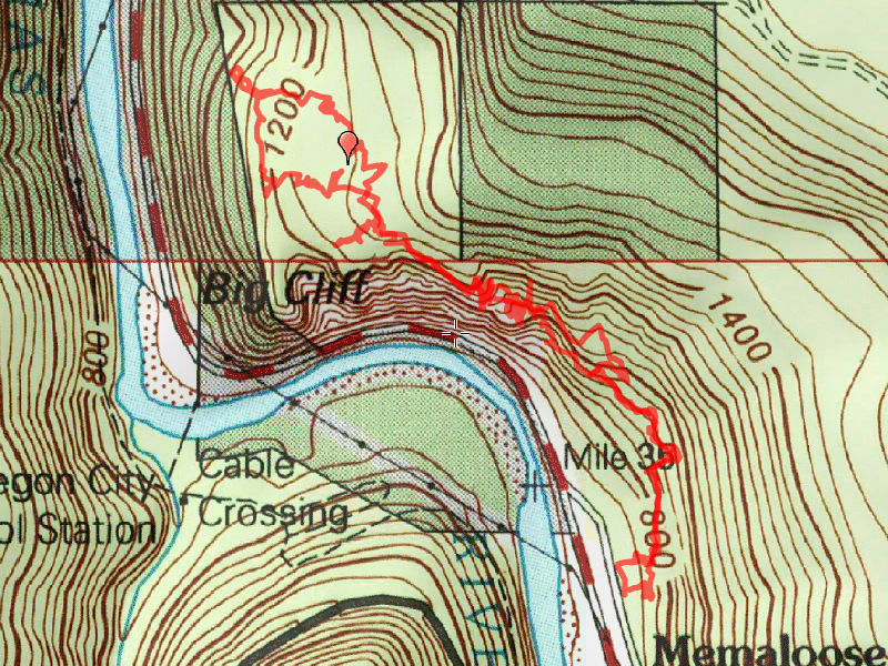
We headed back out and soon got to the trailhead – after driving up a 5 mile long narrow rough road (the whole reason I brought the truck rather than the car and I’m glad I did). There were 3 other cars at the trailhead, which kind of surprised me since we were at the beginning of October and the weather hadn’t been all that great. We weren’t sure if we were going to have decent weather or not – the weather report had gotten better – from rain/snow to showers and possibly some sun – but still forecast to be near freezing at night. We got ready and headed down the trail – the first couple miles of the trail is actually the continuation of the road – it was closed to vehicles due to some washouts but was still pretty much a road. Since the trail was relatively flat and easy walking, we made great time on this portion of the trip. Soon, we got to the Thornton Creek Crossing:

A little farther, the actual trail portion took off uphill. Portions of this were steep and rocky, but overall it wasn’t too bad. As we neared the top of the hill, the trail leveled out a bit and there was a neat meadow area:

We continued up to the pass where there was a side/unofficial trail up to the top of Trapper Peak. Carly had read that it got a bit steep in places but was a non technical climb, so we dropped our packs in the woods and headed up the side trail. It basically follows the ridgeline up the top of Trappers peak, although it does get a bit steep in places:

About halfway up was this interesting, very small (about 8 feet in diameter) tarn:

In about 45 minutes we reached the top – we looked bakc down at where we had come – this was not all the way up the hill, but you can see the ridge route down to the pass:

This gave us some impressive views in all directions. We got a great view of Upper Thornton Lake, which would be very difficult to hike to – it is in a huge bowl:

And here is a view of both of the two upper Thornton lakes:

The views were in all directions and were incredible – we were very blessed with good weather – the clouds had mostly cleared and the wind was very calm. An absolutely beautiful fall day.

Here is a few of some of the fall colors down in the valley from the top of Trapper Peak:

And what it looked like on top of Trapper Peak – there were like 3 little “peaks” with flat areas in between:

Here is a 360 degree panorama video from the top of Trapper Peak:
After enjoying the views for about an hour, we headed back down – we wanted to make sure we would get to our campsite in plenty of time before dark and it was already almost 4:00. So we headed down and shortly got back to our packs and headed over the saddle and down the rough, steep, narrow trail down to the lake. It was kind of a slow trip down since it was pretty tough. Once we got down, we then had to make our way across a difficult boulder field and then across the logjam at the outlet of the lake (it was a LOT harder than it looks – those rocks are HUGE, and pretty steep).

We made it across and then decided which of the two campsites we wanted to use – we opted for the first one, since it seemed a little nicer than the second one, and we would be serenaded by the outlet creek. Our campsite at Thorton Lake:

Here is what the lake looked like from near our campsite – looking up at Trapper Peak where we were earlier in the day:

We set up camp and were both hungry so we made dinner and then cleaned up. By that time it was starting to get dusky and chilly, so we buttoned up the campsite for the night, hung our food and crawled into the tent.
It got cool overnight, but I don’t think it got as cold as was predicted (34 degrees). When we woke in the morning, it was foggy, which I’m thinking might have kept some heat in to keep it a little warmer. We got up, made breakfast and then packed up and headed back up that horrible trail. I had to stop 3 times to take layers off – I was getting too hot!
On the way back up, I stopped to take this photo of the lake, which is kind of a neat point of view:

We made good time on the way back up and arrived at the truck about 11am – shortly after we got there, it started lightly raining – the first rain we had on the trip. We changed our clothes for the long drive back home and packed up the truck and headed out. We had 309 miles and about 6 and half hours of driving (according to Google). We stopped somewhere north of Seattle for lunch and then stopped in north Vancouver for dinner, finally arriving home about 7pm.
It was a very short trip, but it was pretty incredible, and I was very happy to be able to take the trip with Carly. I hope we can plan a trip next year – I really enjoy our father/daughter trips – I assume it will probably be somewhere in the same neighborhood since she really likes the North Cascades.