
| Date | 9/27/2020 |
| Location / Trail | Mosier Creek BLM Land |
| Weather | Sunny |
| Hiking Buddies | Kirk, Ollie and Thor |
| Start / End | 1:45 PM – 3:45 PM |
| Distance / Elev | 4.4 miles 1100 ft elevation |
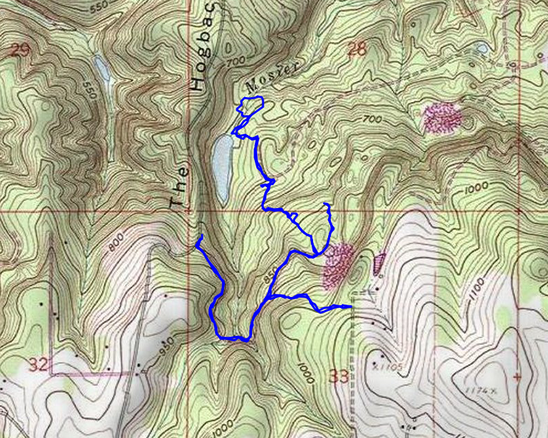
The trail is only about 10 minutes from our house and I knew there wasn’t a ton of space to explore so I figured a Sunday afternoon would be great. We hiked a lot farther than I thought we would be able to. We went a bit off the BLM land, but not too far – and I think Port Blakely allows people on their land – I see people all the time parked at the various entry points.
We headed up the road and soon started seeing lots of side trails – these woods have TONS of trails going all over the place. We more or less stayed on main paths – there is a lot more to explore up here at some point. We headed up and more or less continued straight on the main road/trail. We ended up at the border with the Port Blakely land – a section line – and went just past, but this area was all small trees (it had been harvested within the past 20-30 years I’d guess). From there, we turned around and headed north at another junction – this was on more of a real road I think. We headed up this road looking for a spot to head down to the lake that showed on the map. We finalyl found a side trail that went down to it. I’m not sure what its official name is, but since it appears to be essentially a dammed up Mosier Creek, I’m calling it Mosier Lake – almost a swamp really – not very deep:

We continued north past a second small pond and heard water gurgling, so we looked for the “dam”. We found something that was sort of like a dam – it was some rocks piled up that appear to be somewhat damming up the creek to create the lake/swamp. There appears to be a LOT of people that come in here, as there was lots of activity visible.
Once we found the dam, we needed to re-cross Mosier creek, which we found a great spot – basically a ford of the creek:

We crossed and continued back from where we came. On the way back, we decided to take another junction – we were hoping it might lead to a spot where we could see an odd feature on the map. Neither Kirk nor I could tell what it was supposed to be so we wanted to get a good look at it. The road continued up and ended at a gate along Rutherford Lane:

We turned around and headed back where we came from. Somewhere along the way, I took a photo of what one of the older areas looked like:

There wasn’t really much more of note during the trip – it was short, but this is a very interesting area and one which I’m sure I will come back to in order to do more exploring. It is certainly convenient!