
| Date | 5/21/2022 |
| Location / Trail | White Iris Trail - 502a |
| Weather | Sunny |
| Hiking Buddies | Kirk, Ollie and Thor |
| Start / End | 10:00 AM – 4:20 PM |
| Distance / Elev | 6.3 miles 2500 ft elevation |
We headed out at the “usual” time, and got to the trailhead about 10. I was surprised to see no one up there on such a nice day, but wasn’t upset we were alone. We headed up White Iris from 4614 – I always forget how much elevation this trail gains – it pretty much goes straight up the hill thru a 30 year old clearcut. It is amazing to me the trail even survived.
The bottom portion of the trail was completely clear of snow. About half way up to the 4614 crossing, we saw our first patch of snow, which the dogs played in for a bit:

We saw the White Iris starting to sprout, but it is a few weeks (at least) away from blooming – but the Trillium were starting to bloom:

We continued up the trail, doing a little bit of maintenance to remove winter blowdown in a few spots – we had spent a while on this last year removing quite a bit of small trees that had come down. Other than a few areas, it was in pretty good shape. We continued up, soon making it to the corner and got back into the old growth. Once into the old Growth, the little bit of snow we had in places basically disappeared for a while. As we proceeded north, the trail was essentially clear. It then takes an easterly turn and I think it was there where we started to see a little bit of snow. The amazing thing was that we went from nothing, to this:

To this:

To this:

All within maybe a tenth of a mile or so of the 4614 crossing. The big snow was at the 4614 crossing, but there was probably 6-8 feet of snow there!
This is kind of the obligatory picture of the un-named creek at the 4614 crossing (it is really pretty right there):

We continued across the road and up the hill. It was at this point where the trail became much harder to follow as the snow was a lot deeper. We more or less followed the trail up the hill and eventually got to the Junction with Old Baldy:

At this junction in late 2020, I found a new sign that someone had put up, but we didn’t see it today. Not sure exactly what happened – if someone pulled it down or it was buried in snow, or we just didn’t see it. At this junction we pondered what to do. In the past, we’ve made a big loop, heading up Old Baldy and then back down the Bissell trail, but there was a lot of snow and neither of us packed our snowshoes, so we opted to head back down. It was just too much snow to deal with.
We headed back down and stopped at an old road/landing and had lunch. The trail got re-routed in here when they did a cut – you can still see the old alignment of the trail.
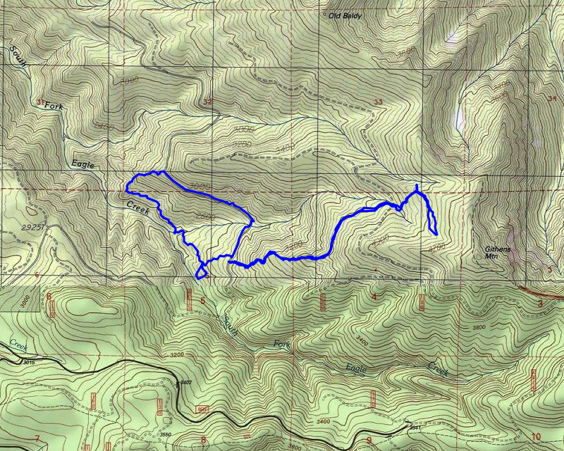
After lunch, we continued down and had a pretty uneventful trip back to the truck. When we got to the truck, we drove up to see if we could get to the Bissell trail – we did, and saw no snow on the road up, which I was kind of surprised by. We turned around and headed back and parked again at the White Iris trail and then headed across the road thru the cut area looking for remnants of the old South Fork Eagle Creek trail. We had looked for parts of it last year but only found one cut log and one blaze. We were hoping for a little better results today.
We headed down to the creek – Kirk and I got separated and I ended up heading downstream a bit thinking that was where he was heading but after some exploration, I realized that wasn’t a good spot for a trail to come down (the canyon in there gets kind of steep on both sides of the creek), so I thought I’d head over to where we found a blaze last time. As I got closer, I heard Thor doing his little yippy barks – he was upset I wasn’t with the rest of the “pack” I guess. We found each other and proceeded downstream, following what seemed somewhat like tread. Along the way, we found some trees that looked like they had blazes on them, but none of them were terribly definitive. The trail we followed was above the creek a ways, but the route made sense because lower down, the hill got very steep.
Along the way, we saw this interesting looking tree:

Not sure what causes something like that, but it was an interesting sight.
We continued downstream, following what might be tread until we got into a fully cut area – part of the area we had been heading thru had been thinned, but not cut entirely. Once we got into the cut area, things changed and we decided to call it. We headed back up the hill back to 4615 and then walked back the road to the truck.
We capped the day off with a stop at Fearless for a beer and a burger. An amazing day out in the woods.