
| Date | 4/14/2012 |
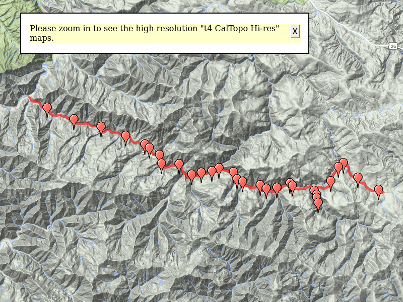
| Location / Trail | Salmonberry Canyon - Coast Range |
| Weather | Sunny |
| Hiking Buddies | Kirk |
| Start / End | 9:30 AM – 7:20 PM |
| Distance / Elev | 16+ miles |
The day started out early – leaving home at about 5:30am. We had planned that the hike would conservatively take about 10.5 hours (16 miles/ 1.5 mph). Factoring in doing all the driving to drop the cars at both ends and pick them up, we figured about 5 1/2 – 6 hrs of driving. We wanted to have a safety margin to make sure we got done before dark, so opted to start early. It was so early, I wanted to stop and get some coffee and breakfast, so we ended up getting a bit of a late start. We ended up at Cochran (after dropping a car at Salmonberry and driving back) at about 9:30am, and headed down the tracks.

Shortly after leaving Cochran, we found a beaver dam where they used the track rail as part of the containment.

We came to Cochran pond, where there used to be a swamill.

The tracks were in really good shape for quite a while, with only blowdown (like you would see on a trail) and a few small slides. We proceeded down the tracks, and in a little more than a mile we came to a “ballast regulator” on a siding. It is my understanding that this piece of equipment was for smoothing out the ballast (gravel) on the rail line. This machine had seen better days, and will probably be there forever now.

A little farther down the tracks we came to the first tunnel. After exiting the tunnel, we found the remnants of a board where you used to fill out an “access pass” (similar to a wilderness permit) to be able to hike the tracks. This was when trains were actively using the route.


Moving on down the tracks, we went through more tunnels, more small trestles, saw some trackside waterfalls until we got to the Baldwin creek trestle. This was the highest of the two big trestles, the supporting structure was mostly steel, with the bridge made out of wood. On each end was a large water tank – we think these were used to water the bridge in the summer, or to use for putting out any fires that might occur in dry months. They looked like tanks from old tanker cars.


After leaving that trestle, we started the series of washouts. They start pretty small, and easy to walk around, but they get bigger and bigger the closer you get to Belding (about the mid point of the hike).

The track takes a journey up Wolf creek – a sharp u-turn and then up the other side. Here you can see the washouts on the other side of the creek:

At the end of the u-turn there is another tunnel and then the second largest trestle – the Wolf creek trestle. This is a curved trestle that is completely made out of wood. It was an impressive sight.


Continuing on, we see more washouts and slides – you can easily see the damage on the other side of Wolf creek. Wolf creek must have been quite active in 2007 to do all of this damage…..We passed washout after washout – some short, some very long. At about mile 4 (or so), we came to a “B&B” shack. I think the B&B was “Bridge & Building” – essentially their maintenance guys. This was an old railcar of some sort that had been converted to a makeshift shop.

A little farther up the tracks was the Kinney creek tunnel and bridge – this was a pretty serious washout, and one of the few water bridges that caused you to make a water crossing rather than walk across the bridge. It was a pretty serious logjam that took out a good portion of the bridge.

Next we came to 3 closely spaced bridges – the river here goes back and forth like an “S”, but the railroad goes pretty much straight. These bridges were all in good shape. A couple more washouts and a tunnel or two and we were at Belding. There is a road that comes in over the tunnel to a parking area.

There used to be a bridge that went over the river here, but it was either washed out or removed a long time ago.

This is where we had lunch, rested our feet a bit, removed our boots and relaxed for a few minutes. Continuing past Belding there are several very significant washouts. The first one past Belding had an interesting thing – a small pyramid of dirt that appeared to have been eroded all around it, but the pyramid stood by itself. It was very odd looking.

At the far end of the washout, someone had taken a ladder from somewhere along the line and re-purposed it to climb out of the washout. It was very convenient.

We continued walking down the tracks through more tunnels, over more bridges (there were a lot of them!) until we came to a huge logjam that almost covered an existing bridge. It appears as though what happened was the logjam got stuck on the bridge, but it didn’t blow out the bridge – it created a new channel for the creek right next to the bridge! Absolutely amazing, and I think it is a testament to the construction of the bridge. It was easier for the creek to cut a new channel than to blow out the bridge!

Farther down the tracks, more slides, downed trees and probably the toughest washout to get around. It looks like it was a combination of a washout and a huge slide, so it took a big portion of the hillside with it. We had to go up and around and then down almost to the river level to get through it. There were are few blue arrows and ribbons to help guide us. I think that washout was probably the peak, and then they started getting smaller (but there were still a LOT of them!).

We continued past more washouts and tunnels, and came to an interesting washout – it showed the detail of something that is normally hidden. It was a square box culvert made entirely of wood. It was still functional even though all the dirt over it had all been washed out. Interestingly, we saw quite a few of these, and none of the ones we saw had plugged up. All the plugged up culverts appeared to be the typical round galvanized, corrugated metal ones.

The rest of the hike was relatively uneventful. We came to the old town of Enright, which consisted of a string of old log cars on a siding, two houses which are still in use, and a water tower.


Following that a mile or so later we found an old piece of equipment that appears to replace railroad ties.

The last highlight of the trip was seeing an inverse rainbow in the sky. Don’t know what caused it – there didn’t appear to be any moisture in the air, but it was late in the day. It was really neat to see it.

The last two miles were pretty plain – we hiked past the old town of Belfort, but didn’t see remains or anything. By that point, we were both tired and just wanted to get to the car.
All in all, a GREAT day – one of my highlight hikes I would say. It was a LONG day – I didn’t get home until after 10:00 – so 5:30am – 10:00pm, and lots of driving – but it was all worth it to see the power of nature’s fury and to see a seldom seen, beautiful coast range canyon.