
| Date | 3/12/2016 |
| Location / Trail | South Fork Clackamas River - Old Waterworks |
| Weather | overcast, rainy and some sun |
| Hiking Buddies | Kirk and Zack |
| Start / End | 9:45 AM – 2:45 PM |
| Distance / Elev | 4.75 miles |
Photos will be coming soon.
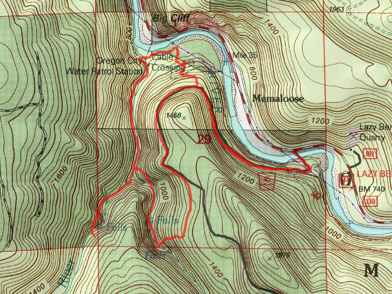
This trip was to explore some of the burned areas up road 45 that were burned as part of the 36 pit fire a couple of years ago. The road has not re-opened, so we walked across the bridge and walked up the road. We weren’t quite sure what we were going to look for on this trip – one option was to explore portions of the old abandoned Memaloose trail, which still existed above (and below) road 45 before the fire.
We crossed the Memaloose bridge and headed up the road, looking at the fire damage on the hillside above the road. We also noticed that all the culverts on the road had been replaced. A new benchmark at the BLM property boundary appears to have been installed as well. I looked for the place where the Memaloose trail took off above the road, however nothing looked familiar to me – I had only been on it one time. We ended up walking up to the old borrow pit and looking around for trail there. We think Kirk found some trail on the ridge at the back side of the borrow pit.
Since we were not having much luck with that trail, we decided to go down and explore the old waterworks. We hadn’t been there in several years and wanted to see what things looked like after the fire. So, we headed across the road, down the old decommissioned road to the “trailhead” – and down the hill to Memaloose creek.
The route has been well traveled since we were last there, and someone has tied ropes down the steep traverse down to Memaloose creek. There are also some new slides which have made things a bit more challenging, but still not too bad. We opted not to go down to see Memaloose falls, and continued down the old road to the bridge at the confluence of Memaloose and the South Fork. It is amazing how much more you can see now that things have burned out. Zack noticed some very interesting rock formations on the east side of the South Fork at the confluence. You could never see things like that before. We also noticed a very long rock retaining wall at the confluence – where all the valves were – we had seen teh valves before, but never the extent of this rock wall – Kirk thinks there might have been some sort of shed roof over it at some point.
We continued up river to the big tunnels and the tall falls. Now that a lot of brush has been cleared, you can get a good look at the falls from various locations – before the only way to see the whole falls was to go down to river level. We got to the “bridge of death” and made our way around the bypass “trail” and then headed up thru the long tunnels. We popped out up on top – there wasn’t as much burn damage up there as I would have thought, though. It had started raining, and it was a good point for lunch, so we went back into the tunnel to eat lunch.
After eating lunch, we headed back down river. As we headed down, the sun actually came out! It was nice for the rain to stop – the sun felt good.
The fireline appears to have been right on that old road most of the way – above the road it was burned, but below it was mostly unburned – there were some big trees downhill from the road that were untouched. We made it back to the area of all the buildings and started looking for the old stove that I had seen someone post. Zack found it – it appears to have been essentially a dump site for this little encampment. There were a couple of old lawn mowers, the old cookstove, a couple of old doors from old cars (model A’s?) and just a bunch of junk. After looking at that for a bit, we headed over to the South Fork to see if we could find a tree to cross on – otherwise we would be heading back the way we came. Fortunately for us, there was a relatively new cedar tree that had come down over the river – Zack shimmied across and cut off the branches on the top so it was a relatively easy way to cross the river. We made it over to the east side and then started looking for the Memaloose trail that headed back up to the 45 road. Shortly we found some flagging and found the tread – still rather faint, but followable. This hillside was burned pretty heavily and there will be a LOT of snags coming down in the future years. As we made our way up the hill, you could see new brush growing in the tread. This area is very open now, so it getting lots of sunlight.
We made it back up to the road, and then headed back down to the truck. A great day in the woods with a couple of good friends. We stopped at Fearless for dinner and met up with some other friends.