
| Date | 12/16/2023 |
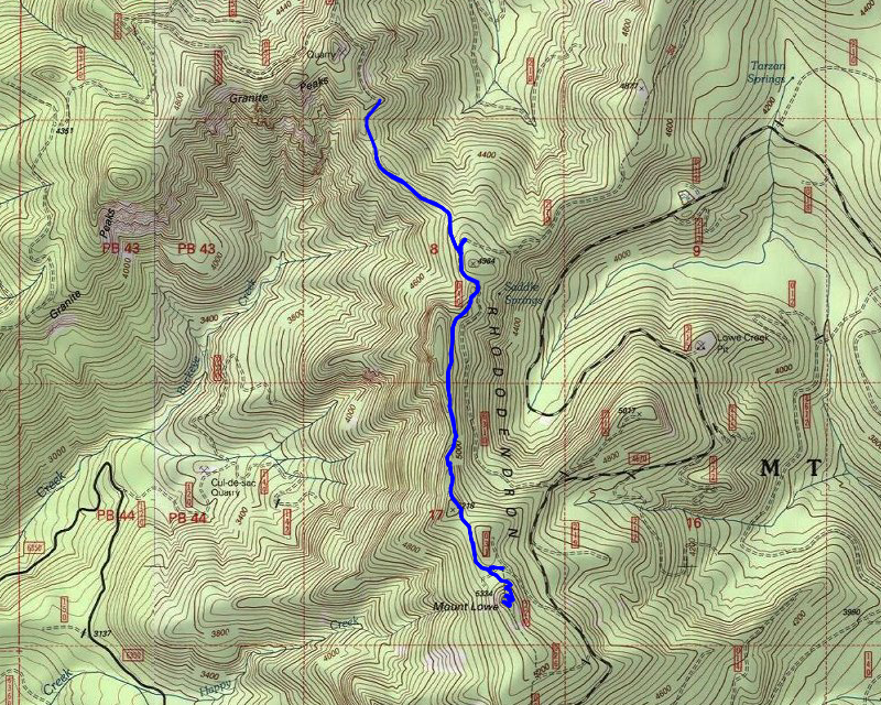
| Location / Trail | Rho Ridge Trail - 564, 562 |
| Weather | Mostly Sunny |
| Hiking Buddies | Thor |
| Start / End | 10:45 AM – 1:55 PM |
| Distance / Elev | 5.5 miles 1100 ft elevation |
The modeled snow depth maps showed the 6310 road pretty clear all the way up. I was a bit hesitant because farther south it looked like there was more snow, but my experience with those maps is that even though they are modeled (estimated), they have been pretty accurate. Thor and I headed out at our usual time and headed up the same path we took a couple months ago, when I hiked the north end of Rho Ridge for the first time in a long time.
The road was clear – the first tiny bits of snow appeared probably about 3000′ or so, but nothing on the road, just in the ditch. As we got higher, bits started appearing on the road but there were ruts down to the gravel and it wasn’t very deep at all. We got to within about a mile of the trailhead and this is when I saw the first significant snow on the 6310 road:

It wasn’t too bad and it still had the ruts and they were down to gravel but as we got higher and closer, the snow got deeper. We went down a pretty narrow segment of road that dropped off on one side and it felt a bit sketchy. It was icy in spots. We got to a wide turn that had a great spot to turn around – I stopped, looked down the hill where we were going to go, and decided to make the safe decision and park there and walk the half mile to the trailhead. After walking it, I’m sure we could have made it but it always best to err on the side of caution, especially when you are alone.
We started walking down 6310 to the trailhead and at some point, I noticed some big prints in the snow – I stopped to take a picture of them with my boot for size:

I’m very sure that is a big kitty – I even looked at some websites and I’m sure it was from a cougar. Thankfully, they weren’t very fresh – it looked like a pretty big cat!
We continued down the road and got to a spot that was clear and had a great view of Bull of the Woods wilderness. From the road you had a great view of several of the mountains – Schreiner Peak, Knob Peak, Bid Slide Mountain, Bull of the Woods:

And here is an annotated shot from PeakFinder which I always find interesting:

I also found this picture from 2007, which shows this same area before all the fires which I thought was interesting:

We continued up the road, passing the junction where the Burnt Granite trail comes down and soon got to the short 6310-040 spur which is the start of the Rho Ridge Trail. We headed up the spur and started down the trail. This is what it looked like near the start:


The snow wasn’t too deep, which was good because I didn’t bring snowshoes. It was probably 2-4″ deep I’d guess and pretty firm most places.
We continued down the trail and at one point there was a small tree that had fallen across the trail. I figured I could saw a small tree off the trail since it only needed one cut. Someone had recently come thru and done quite a bit of cutting of logs and also did some brushing of this northernmost section. I thought cutting this tree off would just help keep it nicer. This is the before picture:

And what it looked like after I cut and moved the trunk off the trail:

After cutting that trunk off the trail we continued south. At one point there was a nice rocky outcropping that had a really nice view of Mt Hood and Mt Adams:

We continued south and since this is a ridge trail, it kind of goes up and down. In one of the saddles it goes thru, a spur road comes up from below. This is where I caught this trail the very first time I hiked it – when I went up to Mt Lowe – way back in 2007. In this saddle, near where it meets the 4670-220 spur, you get a view of Mt Lowe:

The snow in here wasn’t too deep which was good. Thor did a great job of following the trail – a few times I had to stop and look closely. After we got out of that saddle, we started the climb up to the lookout. This was the beginning of the switchbacks up to Mt Lowe:

We went up several switchbacks, looking at a LOT of deer prints in the snow along the way. I finally made it up to the last switchback and there was Thor, impatiently waiting for me on top of Mt Lowe:

Once up here, of course you can’t skip taking the obligatory photo of the remains of the old lookout:

We stopped here and ate lunch. The old steps made for a great seat.
After lunch, I got my drone out and took several videos as well as a 360 panorama:
360 Panorama
Here are the drone videos – first the “cinematic” one:
And then a Pano:
After flying the drone for a bit, I stopped to enjoy the view for a bit. I took quite a few photos while we were up there, as it was a very clear day. Unfortunately, the photos weren’t as clear as it looked in person. Here are some of the photos.
Mt Jefferson:

This was a shot looking kind of NW from the top of Mt Lowe, towards the Fish Creek Divide:

A nice shot of Olallie Butte with a bit of white on top:

And the Three sisters – this was most disappointing because they were VERY clear in person, but not so much in the picture:

After soaking up the views for a bit, and after listening to Thor whine for too long (he wanted to get going), we packed up and headed back down.
On the way down, at some point there was this interesting view of Mt Hood:

After that, we pretty much just headed down. I took a few more pictures along the way, but we didn’t really stop much. When we got to the 6310-270 spur, I decided to head up the road. This is the spur that the Burnt Granite trail comes down. We went up a little way and it was getting harder (the snow was getting deeper) – I since it was just road walking, I decided to turn around and head back down. The snow was a lot softer on the way back down as it had warmed up quite a bit.
When we got close to the truck, there is an old quarry that has a beautiful view over to Bull of the Woods. When we entered this area, it felt like it warmed up at least 10 degrees – it was really kind of odd. I also noticed that while we were on the trail, someone had driven down 6310 and then come back, so we weren’t the only ones up that far today!
We were soon back at the truck and ready to head out. Just like last week, the key fob didn’t want to open the truck. I warmed it up in my hands a bit and it finally opened it. I need to replace the battery in the fob – it is coming up on 5 years old and I’ve never replaced it so I think it is time. The cold makes it worse.
It was a relatively short, but beautiful day in the woods. I was amazed we could drive to almost 5000′ on the 16th of December! I know that won’t be the case for much longer. These trails will very soon be under their winter cover of snow for the next several months.