
| Date | 7/6 - 7/10/2016 |
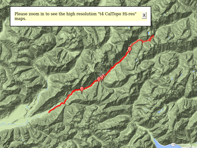
| Location / Trail | East Fork Quinault Trail |
| Weather | mostly cool and misty/rainy |
| Hiking Buddies | Kirk and Sarah |
| Distance / Elev | 43.5 miles |
This was my annual backpacking trip. Unfortunately, Carly was not able to join this year, so Kirk, Sarah and I went to explore the Enchanted Valley in the Olympic National Park. The trip took us up the long East Fork Quinault river valley.
This was the plan:
- Day 1 – Graves creek to O’Neil Creek – ~9 miles
- Day 2 – O’Neil creek to Enchanted Valley – ~ 6.5 miles
- Day 3 – Enchanted Valley to Honeymoon Meadows – ~6.5 miles
- Day 4 – Honeymoon Meadows to Pyrites creek – ~ 10 miles
- Day 5 – Pyrites creek to Graves creek then home – ~ 12 miles
Our itinerary changed a bit during the trip. More on that later.
The first thing I have to say about this trip is that it was absolutely the wettest backpacking I’ve ever done. Technically, it rained every day of the trip. The humidity was so high that it was almost impossible to dry anything out, even though we had a campfire on 2 of our nights. That was not terribly enjoyable, but being in a rain forest, it is to be expected.
Secondly, I found myself continually saying “wow” during this trip. The number of HUGE trees on this trip is incredible. Everywhere you look there were big trees and HUGE trees. Looking at those huge trees never got old.
Thirdly (and definitely not any less importantly), we got to see 2 bears – one up close and personal (20-25′ away), and a big herd of elk as well as a host of other small animals and birds. The wildlife on this trip was really cool.
Now, on to the details.
Day 1 – Graves creek to O’Neil Creek – 9.4 miles
Kirk picked me up about 7am for the long drive to the trailhead (about 4 1/2 hours according to google). We had kind of factored that into the plan so had a relatively short day planned. We had to go to the ranger station at Lake Quinault, register, and we got 3 bear canisters (required in the valley now – you can’t hang your food anymore). The ranger went over all sorts of rules, regulations and told us about the big washout about 7 miles up the trail. He also made kind of an odd comment – that we had “flexibility in our scheduling” – meaning we weren’t REQUIRED to camp in the places on our plan/permit. I just thought it was an odd comment since so many things can change when you are backpacking so your plans need to potentially adjust to the conditions. Maybe he was just assuring us that it was OK to deviate from what we had told them.
Anyway, we got all that done, paid our fees, loaded up our bear canisters and decided to have a “last supper” in civilization. There was a general store with a small cafe in it that sounded perfect. It was quite interesting – we had to wait a while until they cleaned the grill from breakfast – then it took a while to get our orders and finally our food. It was good – it was just kind of slow – they had a sign that say “we can’t promise fast food, but we can promise good food”. I think they lived up to that promise.
After our “last supper”, we headed back to the van and on to the trailhead. Last winter was really rough in this area, and it washed out the road about 2 1/2 miles from the trailhead so we had to park on the road and hike up the road to the real trailhead. We knew about this beforehand, so had planned it into the schedule. We got packed up and headed up the road, making good time since it was pretty easy hiking. Shortly, we got to the real trailhead. We stopped there to use the bathroom (the last “real” bathroom we would have for the next 5 days), and then headed up the trail. The trail starts by crossing Graves creek on a nice bridge (which I didn’t get a picture of). It then continues up what appears to be an old road (it is REALLY wide).

Shortly, we saw an old water tank next to the trail which was obviously not being used anymore. We were thinking it might have been used for water at the Graves creek campground – there was something similar/newer in the parking lot of the trailhead.

A little farther up the trail we got to the junction with the Graves creek trail – a more primitive trail. There was also a really nice sign showing mileage to our various destinations we had planned:

A little farther up the trail we found a very old picnic table (probably used when this was still a road):

Continuing on, we got to our first Quinault River crossing – the “Pony bridge”:


We enjoyed the views from the bridge in this slot canyon and the proceed down the trail. It continues thru the rainforest and shortly crosses Fire Creek:

Shortly after Fire Creek we found the sign for the O’Neil Creek campsite – it is quite a bit below the trail right next to the river. We found a good spot and setup camp for our first night:


We explored the “jungle” that was this camp – it was nestled in a grove of mostly salmonberry and it was over our heads. They have carved a path thru it, but it is still pretty thick. We found the “bear wire” that was there for hanging food:

We made dinner, cleaned up and were all tired so we went to bed.
Day 2 – O’Neil creek to Enchanted Valley – 7 miles
After we went to bed on day 1 it started raining – Pretty much all night. Fortunately, it stopped by morning, but everything was wet by then. So we had to pack up wet tents. We headed back up to the trail and continued thru the magnificent old growth rain forest:

We knew the big washout was not far. We should have known we were in for trouble when we saw this flagging at the start of the re-route:

We were guessing the bone was to keep the flagging visible. It was kind of weird to see, though.
The re-route was really a user boot path thru the area. We had to cross a lot of pretty large downed logs:

Before finally crossing the river on a huge log to bypass the washout:

We then crossed another huge log a bit upstream to get back to the trail – the washout section was about 1/4 mile total. Winter was not kind to this section of trail. Fixing it will be a huge effort.
After successfully traversing the big washout, we continued down the trail, passing huge trees that had been previously cut, as well as some fresh ones:

We then successfully crossed no name creek (yes, that is really its name) and kept hiking thru these giant trees:

And more giant blowdown:

We then started into the beginning of the valley – it is a LONG valley:

And we came across another one of these side channel washouts (I’m not really sure what to call them). This one was kind of unique though, in that it had these big huge cedar trees below which were interesting. We weren’t sure if they were multiple trees that had grown together or if it was one tree that grew multiple stems. They were certainly massive though (as pretty much everything in this valley is).


the trail kind of flattened out and we hike a flat section for a while. We came to this “forest art” (as Sarah called it) – a HUGE cedar tree that had uprooted a long time ago – pretty cool:

And a little bit farther down the trail we found an old phone line insulator – this was not he only one we found, but it is the only one I took a photo of:

Continuing down the valley we found the spot where the trail crews had cut up logs for various projects:

And then this really strange “gate”:

That gate was kind of the beginning of the “real” valley – where the chalet was. Once thru that gate, the trail opened up quickly and we got our first glance at the chalet off in the distance. But before we could get to the chalet, we had to cross the river again – this time at a narrow section. They had this cool, kind of scary bridge to cross:

It was about 80-100′ long and 30-40′ above the river. It was kind of odd it only had one handrail given it was so high up. But we all successfully navigated the bridge and shortly arrived at the Chalet:

Since it was raining we decided to get some cover under the porch of the chalet and figure out where we wanted to camp that night – either in the valley or farther up (to make the trip to Honeymoon Meadows shorter). We scouted the sites around the meadow and found a good one under the trees – it had a fire pit and was pretty sheltered from the rain. Since it had been raining/misting most of the day, we decided that would be a great place to camp. We were hoping we could make a fire to maybe dry a few things out too. We also had firmed up our plans to stay here for 2 nights and just do a day hike up to Anderson Pass instead of trying to camp up at Honeymoon Meadows. That turned out to be a very good idea in retrospect. The going continued to get rougher and the weather continued to get worse.
Once we got camp setup (I did not take a photo of that campsite unfortunately), we started exploring the valley around the chalet a bit. Although it was foggy, you could see waterfalls coming down the west side of the canyon like this one (this was the most prominent one):

We also went up and explored the waterfall on the east side – above the chalet. It appears as though this used to be the source of water for the chalet, although the regular “gulley washers” have destroyed whatever dam or setup they had to capture the water. The line also got exposed part way down and is broken in two. The waterfall was very pretty though:

Before dinner I headed down the meadow a bit further and got a little better look at the lower portions of the waterfall:

As well as another above a snowfield:

Around dinner time, a ragged hiker arrived in camp and asked if he could borrow a pan to boil some water. Apparently he had forgotten to purchase a pan and had lots of dehydrated food which is of little value without boiling water. My jetboil really has to be used on my stove, but Kirk offered up his pan. The man was thankful and said he would eat and then was headed out. I’m not exactly sure what transpired, but he ate, walked around a bit and then setup his tent. He ended up spending the night. Apparently he hadn’t been feeling well, and he decided to stay in our camp for the night and get a good rest and head out in the morning.
After my brief explorations, we cooked dinner, started a fire and attempted to dry a few things out. We were semi-successful and ended up going to bed somewhat early.
Day 3 – Day hike to Anderson Pass and Siberia Camp – 10.6 miles
We got up about the same time (7:00), got breakfast ready, cleaned up and then headed out north up the valley thru the giants:

A bit farther up the trail was the high point of the trip for me. We stumbled upon a large herd of elk in a meadow below the trail:

The elk heard us and got up and started heading uphill out of the meadow. While that was happening, I heard rustling in the bushes beside us, and then I saw a black head. Shortly, he rose up to see what was going on – it was a BEAR – not 20 feet or so from us:

It was kind of scary and kind of exciting all at the same time. He didn’t seem interested in us in the least. Once he saw what was going on, he sat back down and continued to eat the huckleberries in front of him. Once the elk had exited the meadow, we moved down the trail, keeping watch behind us for the bear. He just kept on eating.
With that excitement behind us, just 3/4 mile or so from camp, we continued north. Looking up at the west canyon wall, there were more waterfalls – someone told us this place has the nickname of “valley of 10,000 waterfalls”. I think that is a bit of an exaggeration, but there certainly are a LOT of waterfalls here:


We also got just a hint of blue sky – Kirk got excited, but it was not to stay too long:

We continued on, the brief blue sky turning to mist and then turning to light rain. A bit farther along we got a good look at the carnage of the alluvial plain of the river:

This is a VERY active river, changing channels frequently.
When we got to the white creek crossing, we found the bridge had been tipped over – a temporary log had been put in place to cross, which was good because the creek was flowing fast:

And there was a beautiful waterfall both above:

And below the crossing – this waterfall was interesting because it made an almost 90 degree turn right before going over the edge. There was a rock face that turned the water – it is kind of hard to see in this photo, unfortunately:

We continued up the trail, gaining elevation as we went on our way to Anderson Pass. On a clear day, the views from this portion of the trail must be incredible. But today, we got lots of clouds:

We shortly cane to another one of the many side creek crossings, but this one was particularly interesting. When we got to it, it was flowing pretty well, with muddy brown water:

On the way back, it was barely a trickle:

We continued up the trail and got a pretty good view of the beginnings of the Quinault River – it flows from the lake below Anderson Glacier. you can see it about mid photo below:

We soon made it to Anderson Pass – thru the rain and wind:

We were tired and wet, but our friend back in camp had told us about an old shelter that was just over the pass. We thought if it wasn’t too far we would go explore it before turning around. We all decided that Honeymoon meadows and/or the Anderson Glacier was not in our future. They were just too far. We looked out over the valley and saw a meadow and then I glimpsed the shelter just down the hill. It was not too far, so we headed down to find it. On the way, we got this great view of Mount LaCrosse:

And then shortly to this old shelter which we were later informed was called “Camp Siberia”:

We stopped in the shelter for a bit to dry off and eat something and have a little water. The shelter has had some work done to it recently and there was more wood stacked outside, so it appears as though it will be getting more work done soon. It is amazing it is still standing – a cool artifact from a bygone era.
We knew we had over 5 miles to get back to camp and it was already after 2:00, so we headed back up the hill to Anderson Pass. On the way back I saw all these wildflowers that I had not noticed on the way down:

We got back up to Anderson pass and the small tarn/lake there:

We continued down the trail, back the way we came. Along the way, I saw this view of what I think is that beginning of the Quinault river. It is a different view coming down the trail than going up:

We continued down, making good time since it was mostly downhill. Getting closer to camp, we saw a couple of hikers and then saw a sign pointing to the largest recorded Western Hemlock. We followed a short trail down to the river and found it – it was certainly a very large hemlock:

After enjoying brief moment of sun in the river channel, we headed back to camp. On the way back, the same herd of elk we saw in the morning was in the meadow near our camp. We passed by them on the trail, although this time they did not move since they were off the trail a bit. They watched us intently as we passed by. They were pretty close – this is a shot from next to Sarah’s tent:

We made dinner, cleaned up and then made another fire – in the hope we could dry things out a bit. It seemed like we were having some success, but alas things got wet again so easily.
After dinner, I noticed the cool cliffs behind the chalet:

We enjoyed the warmth and dryness of the fire. Probably around 8:30 or 9, Kirk saw a bear out in the meadow lumbering around. It was too dark to get a picture, but I’m thinking it was probably the same one we had seen earlier. He just kind of wandered around sniffing things until he wandered off into the woods below the waterfall. We stayed up and enjoyed the fire until around 10 and then went to bed.
Day 4 – Enchanted Valley to no name camp near Pony bridge – 9.8 miles
Day 4 was a relatively uneventful day. The goal was to get back so we could have a shorter day on the last day so it wouldn’t be so long of a day (with the 4+ hour drive home). We were thinking of trying to get to the campsites at Pony Bridge, but we would see how things went. I woke up with a huge blister on my big toe of my left foot. Having my feet wet all day long was making it hard on them. Kirk had a safety pin, so I sterilized it and then popped it and bandaged it up as best I could. I was hoping it would do OK.
We made breakfast, cleaned up and then packed up camp, getting on the trail around 9. We got back to the “scary bridge” and noticed it had a Columbia Helicopters sticker on it, so we assumed they were the ones who flew it in. It was definitely quite a job to install this beast:

We went over the bridge, and headed back down the valley, getting our last glimpse of the chalet:

We continued thru the weird horse gate and down the trail. Although this was supposed to be mostly downhill, due to the river and the terrain, this trail has a lot of ups and downs in it. A ways down the trail we found a great bear print in the mud (notice how wet my boots are!):

It didn’t look like a huge bear, but it was cool to see.
As we went down the trail, we met hikers. As we got closer to Pony Bridge, we met a couple of guys who weren’t sure there was any room at Pony Bridge (that is where they were camped). My feet were bothering me and slowing me down as well. Kirk had been looking for an “unofficial” campsite next to the river. He noticed a side trail at one point with no obvious campsite, but headed down there to investigate. It was a ways off the trail, but he found what we think was a camp that the trail crews use. We found stuff stashed behind big logs, including 4 big aluminum bear boxes (we were guessing they must have brought them in via horse or mule at some point). It was a great campsite right on the river with a good access point for water. Even better, we had it all to ourselves! We stopped, setup camp and then it started raining – harder than it had been. There was a relatively dry spot under the tree where the campsite was. You can see a kind of dry spot where Kirk is sitting:

Soon, the dry spot was getting dripped on. We were thinking about doing a fire, but since the fire wasn’t protected like the last campsite we had, and it was raining harder, we decided not to. It was too bad too, because Kirk had carried a couple of pieces of pitchy wood a couple of miles in anticipation of a fire.
I made the following short video – you can hear the rain (you can’t really see it):
We made dinner, cleaned up and then went to bed early because of the rain.
Day 5 – Noname camp to Graves creek then home – 6.5 miles
We awoke to a foreign sight on the morning of Day 5 (Sunday morning) – Sunshine! Real sunshine! It was the first real sunshine we had the entire trip. Unfortunately, it didn’t reach the camp to dry our tents before we had to leave. But it lifted our spirits. I think we were all tired of being wet and stinky and were ready for a good lunch, followed by a warm, dry ride in a comfortable seat and then a hot shower and sleeping in our own beds again.

We made breakfast, cleaned up and then packed up camp. We got going a bit earlier than previous days and then headed back to the trail. Right where our side trail met the main trail, we met two guys on their way in. We chatted a bit and found out that one of them was the guy who moved the chalet in 2014! He was a driving force behind getting it saved from destruction. They were headed in to check it out. It was an interesting conversation.
After chatting for a few minutes, we said goodbye and headed down the trail. Nothing much exciting happened – I think we were all focused on getting home. But a bit down the trail, we encountered 6 happy guys. One of them touched each of us on the shoulder and said something like “have a great day, man”. They were all very happy and smiling – it was a bit weird, and I wondered if they might have had some “assistance” getting happy, but they were harmless. Just kind of an interesting sight along the trail.
Nothing much else happened along the way – we just pounded out the miles. I stopped and got a photo of the Graves creek Ranger station, which is probably no longer being used due to the road being washed out, but is a cool old building:

We continued down the road, and shortly before the washout, came to this neat roadside waterfall:

We made it back to the van about 11:45. We quickly loaded up and headed out. Our goal was to drop off our bear canisters, get cleaned up a bit (Sarah and I had clean clothes in the van) and then head up to a pizza place up the road for lunch. Then head home.
The pizza tasted really good! And it was nice to sit on a seat that wasn’t hard plastic (my bear canister). We made it home by about 5:30, so it wasn’t a late night like we originally thought it would be.
This trip was another difficult trip – for many reasons, but it has to be one of my top trips due to the elk and bear sightings – plus the natural beauty that is everywhere on this trail.