
| Date | 1/1/2014 |
| Location / Trail | Rho Creek Trail - 569 |
| Weather | Mostly Sunny |
| Hiking Buddies | Kirk |
| Start / End | 10:55 AM – 4:30 PM |
| Distance / Elev | 8 miles |
We got a lazy start, since it was New Years Day, but got up to the trailhead by a little after 10:30. The driving was a bit tricky, since there was lots of ice on road 46, and also LOTS of rocks that had come down from cliffs – some rather large rocks that required driving around.
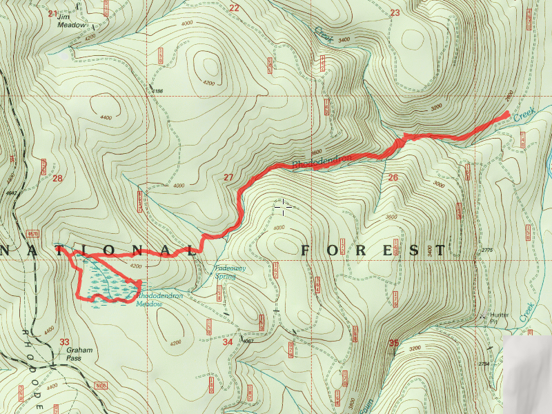
Anyway, we headed up the trail – I had forgotten how much elevation this trail gains. The beginning of the trail climbs rather quickly. It is graded well, but you are gaining elevation rather fast. In a short while, we came to the Tumble Creek crossing:

Tumble/Rho creek is beautiful:

After crossing Tumble Creek, we headed up a couple of switchbacks, gaining more elevation before coming to the upper clearcut. It was here where I made an incorrect turn in 2006 (the last time I was on this trail). I turned right (NW) and headed along the edge of the clearcut. I should have continued mostly straight along the other edge of the clearcut, which is where the trail follows. We proceeded up the trail to the 4672 road, which was almost snow free – amazing for a road at 4000′ elevation on the first of January:

We continued across the 4672 road and headed uphill. After some more uphill, the trail levels out and the forest changes to smaller trees and more open:

After following this for a while, we got to a post that used to have a sign on it. We weren’t sure what it was marking. The notes I had sounded like this was a trail junction, and “turning left” would take us to the Guard station, which we wanted to find. We followed a very rough, faint trail for a while – it kind of came and went. We thought the guard station was near the meadow, so we continued on to the swampy area – it is actually called a meadow – Rhododendron Meadow. Maybe later in the year it is drier – today it was icy, otherwise it would have been hard to walk across.

We didn’t see any sign of the guard station site, but we were a bit confused about where exactly it was. We were running out of time for the day, so we decided to head around the meadow and find the trail that we came in on. We found the trail and started heading back, and lo and behold, we stumbled across the old collapsed guard station!

On the way back down, right above the 4672 road, we caught this nice glimpse of Mt Hood:

About half way back to the start, we saw something we missed on the way in – a post – it definitely said something at one time, but what did it say? It certainly didn’t look like a trail junction, so what could it have been for? I’ll probably never know (edit: I later learned that this post IS an old trail junction – the trail has long been abandoned and is pretty faint):

We were kind of in a hurry on the way back, racing to get back to the truck before dark (the days are very short this time of year), but I couldn’t help but take a photo of this section of the trail:

I can’t really say this is “typical” since this trail goes through so many different areas. But it is a very pleasant area. This trail is a very under appreciated trail. I will be back again sooner than 7 years next time.
We capped off the day with a burger and pint at Fearless. What a great way to kick off the new year!