
| Date | 9/11 - 9/14/2015 |
| Location / Trail | Devils Dome Loop - Psayten Wilderness - Washington |
| Weather | Sunny that turned into cloudy and cooler |
| Hiking Buddies | Kirk and Carly |
| Distance / Elev | 41 miles - 33 miles by foot, 8 miles by water taxi (boat) |
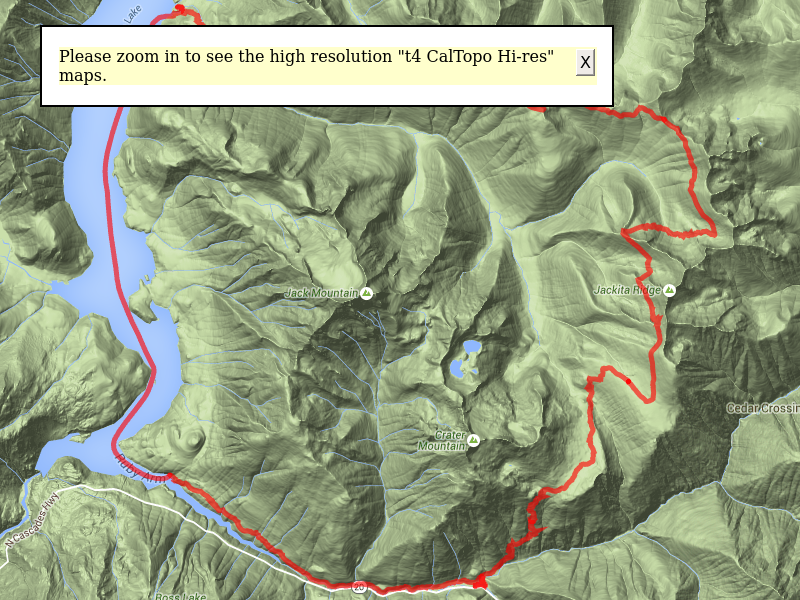
So, the plan for the trip was to go pick up Carly in Chelan (she was working on Stehekin all summer) off the ferry on Thursday, camp somewhere near the trailhead, and then head out early on Friday for our 4 day adventure. Due to the length of the trip, we opted to take the water taxi to cut off about 8 or 9 miles off the loop – from all the reports I saw, we didn’t miss too much – no real views, just kind of hiking around the lake and then over Hidden Hand Pass, which didn’t sound all that scenic. Night 1 was to camp at Devils Park (with a shelter), night 2 at Devils Pass, night 3 at Devils Creek/Junction along Ross Lake and then on day 4 take the water taxi around and then complete the loop and then drive home (a very long drive). This area is almost to Canada – we were less than 10 miles from the Canadian border (the top of Ross Lake is in Canada)!
We were a few minutes late picking Carly up from the ferry (a small miscalculation in how long it would take to get there), but we ended up only being about 10 minutes late – my luck was that the ferry was right on time! Anyway, we picked her up, went into Chelan, had dinner, got gas and then went out to find our campground for the night. Originally, I wanted to camp at Loup Loup campground, but we found out that it was closed due to the fires. We ended up staying at JR campground which was nearby – it was starting to get dark and we just wanted a place to sleep for the night.
One interesting thing that happened – we were setting up camp, and not one, but THREE rangers came into the campground – they had reports of a “huge bonfire”. They asked us if we saw anything and we had not – turns out it was probably a white gas stove that had gotten a bit out of control when it was starting up – someone saw that and reported it. While the rangers were there I asked for a good breakfast place for Friday morning and also about the permits I was told we needed at Ross Lake – there was a ranger station in Winthrop. He told me about a great breakfast place a “combination restaurant and sewing place”. It sounded interesting, so we decided to try it – if we could find it.
Day 1:
The following morning, we packed up camp and tried the rangers suggestion – probably wouldn’t have stopped there had he not said anything, but the breakfast was really good – the sewing stuff was quilting supplies. After breakfast, we headed down to the ranger station for our permit, which I understood to be similar to the wilderness permits – you basically fill out the tag and go. This took quite a bit longer than that. It took over a half hour to get all the correct info and get the permit. Once that was done, we headed down highway 20 to the Canyon Creek trailhead to start our adventure – a little later than we had planned.
We got there about 10:30 and headed out shortly after. Here is Carly hamming it up for the camera in the parking lot:

Shortly after starting, we got to the bridge across Granite Creek:

And a little farther, this old cabin on Canyon creek:

We then headed up the unrelenting switchbacks to gain the 4000 feet of elevation we needed to gain to get to McMillan Park. Most of the day was just grunting up the hill, stopping for rest breaks and stopping to fill up our water bottles. Part way up the hill, out of nowhere, I got stung by a bee on my arm! That was kind of a bummer, but fortunately, that was the only sting of the trip.
Shortly before one of the creek crossings, we ran across the first of our “mountain chickens” (grouse). There were actually 2, however one was down off the trail. When Carly came thru, they were both on the trail. I “chased” this guy down the trail aways before he finally jumped off the trail.

After what seemed like an eternity of hiking up, we finally arrived in McMillan Park and had completed the majority of our elevation gain for the day. There were beautiful fall colors on display in McMillan Park:

We continued thru McMillan Park and ascended our final elevation gain until we reached the shelter at Devils Park:

This is where we camped on night 1. The shelter is in reasonably good shape for something that is close to 80 years old. It is missing some of its roof shingles, but still seems pretty much intact. Although there were annoying bugs (gnats, flies and the occasional bee), interestingly enough they didn’t appear to like to go into the shelter. We couldn’t figure out why, but it was nice to be able to get away from them in the shelter – it also had nice benches for sitting.
The evening of day 1 was uneventful – cook dinner, clean up, hang our food and then we went to bed. A couple of interesting things happened overnight. First, I had to get up to pee in the middle of the night – I unzipped the tent and heard a flurry of thumps – I had startled some large hooved animal that was probably grazing in the meadow. I never got a look at it, but from the noise it made, I’m guessing it must have been an Elk (or maybe 2). It sounded too big to be a deer. We found lots of signs of elk in the meadow.
The second thing was Carly wanted me to wake her up to take night sky photos – we set an alarm for 1:00am and it went off but I couldn’t wake her up. Oddly enough, she woke up herself around 3:00am and took some cool photos of the night sky:

Day 2
We woke up on day 2, cooked breakfast, packed up and headed down the trail. The trail continues thru the meadows, and then starts another long ascent up the south end of Jackita ridge. Today was the day the big views really started. Crater Mountain and Jack Mountain would be our almost constant companions for the next 2 days:

Needless to say, Carly was well ahead of us almost the entire trip – she had spent all summer in Stehekin doing hikes and backpacking trips, so she was in pretty good shape – plus she was 30 years younger than us! We continued north on the trail, and we got to a ridge where we found Carly’s backpack and a side trail that went up to the top of an un-named peak along Jackita ridge. We saw Carly at the top of the peak:

We waited for her to come down and then continued down these horrible switchbacks – sometimes heading almost straight down the hill:

We finally got down these switchbacks safely, and continued our descent – this was the theme of this trail – almost always going up or down – very few level stretches, and a lot of the up and down was not well graded – it went straight up or straight down. We stopped for lunch near an un-named creek (maybe the South Fork Devils Creek?) and then continued ascending to a ridge, which then plunged down to the North Fork of Devils creek. We followed this creek up the hillside, heading east until we got to our “final” elevation where the trail headed pretty much north. There was a neat waterfall and campsite near the top of the creek:


The trail from here pretty much kept to the same elevation and was very pleasant walking, although we were very tired after 2 days of aggressive elevation gain (in 2 days, we had done about 15 miles of trail and 7300 feet of elevation gain – all with full packs).
A short descent put us at Devils pass:

And once there, we saw more “mountain chickens” (grouse):

And a cool old sign – this sign must be REALLY old – it appears as though the post has rotted away:

We setup camp and headed down to the spring shown on the map – we were a bit worried it would be dry since we were late in the season and it has been such a dry year. I filled up with extra water at the last opportunity just in case we didn’t find any. Kirk was able to coax a bit of water out of the spring, even though it was flowing slowly. I had enough water from the last fillup, so didn’t try to use the spring. One thing we didn’t find was the “pipe” out of the spring that I had seen mentioned. Maybe it was on the upper trail or something, but we never found it.
After we got home, I found out that if we had followed this water trail to the end, we would have found the old, now collapsed Devils Pass Shelter. We only followed the trail to the spring. We thought the Devils Pass shelter would have been at the pass. Oh well….I don’t think we missed much.
We cooked dinner, hung our food and caught the sunset and some Alpenglow from the pass:
Alpenglow – not sure what peak this is – maybe one of the un-named peaks northeast of Devils Pass:

Sunset from Devils Pass:

We went to bed early again (with the sun) – tired from another day of hard hiking.
Day 3
We woke up on day 3 to clouds – we weren’t sure if we were going to get rain or not, but we would make the best of whatever Mother Nature threw at us. Kirk had gotten up early and climbed the ridge that was northwest of the pass – this was him coming down – he said the views weren’t great due to the clouds:

We cooked breakfast, cleaned up and broke down camp. We tried to get a little bit of an earlier start since we had a longer day ahead of us (~12 miles). By the end of the day we would be down at Ross Lake.
We headed down the trail, and shortly saw this tree that looks like a bear had been scratching on:

As we continued along the trail, we were a bit concerned due to the threatening clouds:

But we continued – we were prepared for whatever happened. The trail in this part was pretty well graded for the most part. This one section was particularly interesting, following a bowl around with a very nice grade – made for easy walking:

The trail continued until we could start to see the beginnings of Devils Dome, the highest point on our trip. At this point, the wind had picked up and was intermittently chilly:

But we were getting some more fantastic views – looking North up the Middle Creek drainage:

And the seemingly never ending “up” of these trails:

Until we finally got to Devils Dome – just shy of 7000′ (6982′) – Carly on top of Devil’s dome (near the campsite):

When reading trip reports, some people found this area to be the high point of their trip – It wasn’t for me – I was just COLD – it was very windy up there. For me, it was interesting, but not a high point of the trip. Maybe if the weather had been less severe up there it would have changed my mind. I know some people camp up there due to the great views. It is VERY exposed, so it would be prone to being very windy. Not my preferred spot for a campsite.
After crossing Devils Dome, we started our long (5000′) descent to Ross Lake and got ready to say goodbye to Crater and Jack Mountain.
At one point while heading down, Kirk noticed an ice cave on Jack Mountain (zoomed in):

And shortly, we came to my favorite viewpoint of the trip – this rocky outcropping:

Unfortunately, none of the photos capture the dramatic view on this outcropping – it drops very precipitously down to Devils creek and then Jack Mountain is right there. Incredible views:


We stayed there for a few minutes, resting and grabbing a snack, enjoying the view. From there, we continued down the trail and decided to take a short side trip to the Bear Skull shelter where we had lunch:

We ate lunch, explored the area a bit, filled up our water in the small creek and then headed back to the trail to continue our descent to Ross Lake. On the way, we got our first peek at Ross Lake:

It was shortly after this point that we started our heavy descent, and had to say goodbye to Crater and Jack Mountain – we would be entering the trees and would not seem them again, except for a few glimpses here and there.
On the way down the narrow, steep, brushy trail, we found an interesting artifact – a tree with a very old mile marker plate on it, and also with old telephone wire on it:

This meant we had around 3 miles to go to Ross Lake – our destination for the night. I’m not sure the 3 miles was to the point where we were camping, but it was still an interesting artifact. We were eager to jump in the lake to wash the “funk” off (that was a term another trip report used, and was pretty accurate).
We finally made it to the hikers camp above Ross Lake – the signage was somewhat confusing, but we finally figured it out. We got there around 3:30, setup camp and then Kirk and I went down to the lake (a half mile hike) to jump in and get cleaned up a bit. It was pretty chilly, but it felt REALLY good to wash all the “funk” off and feel somewhat clean. We had been sweating a LOT – my shirts even had salt stains on them when they dried!!! After Kirk and I cleaned up, Carly went down to clean up.
Ross lake is a beautiful lake – smaller than Lake Chelan, but still very large – about 20 miles long:

This was the view from our camp above the lake:

While we were at the boaters camp (right on the lake where the dock was where we would get picked up the following morning), I looked around the campsites – I ended up finding an iPhone 6! After we got home, I was able to reunite it with its owner – surprisingly enough, he lived in Portland! Small world!
Sunday night was pretty uneventful – cooking dinner, enjoying the views of the lake, cleaning up and hanging our food. After dinner, Kirk decided to take a jaunt down the lakeside trail to see where that trail crossed Devils Creek – it is a cool suspension bridge (this photo was taken on the boat ride the following morning):

Carly and I went to bed with the sun again (although it was probably a little earlier due to the clouds making it get dark sooner). Kirk got back to camp a little after dark. I wanted to go with him, but my feet were really tired and needed a rest for our final day of hiking.
Day 4
The plan for day 4 was to get up early, eat breakfast and be down at the dock by 8:45 since our ride was supposed to be there at 9:00. We wanted to be a little early just in case they were early. We were going to leave camp at about 8:30 to give us time to get down there – but at about 8:15 we heard a boat coming up the lake – I had already packed up, so I raced down the trail to the campsite – Carly and Kirk finished packing up and joined me a few minutes later. Fortunately, that boat was not our boat, but our boat did end up being early, so it was good I went down when I did. We got on the boat about 8:45 and he took us down to Ruby Arm, which has a trail that meets up with the lakeshore trail and heads along Ruby creek back to the trailhead where we started our adventure.
Some photos of the boat trip:

One of the fires from this summer is still smoldering a bit up the hillside:


Once we got off the boat, we made the ascent back up to the trail. At this point, it looked like a road it was so wide:

After seeing artifacts along the trail, we figured this portion of the trail must have been an old road. We found culverts, old telephone wire and other artifacts, and the corridor just looked like it used to be a road. This portion of the trip was pretty uneventful – not a whole lot to see other than Ruby creek, which was very pretty. We got to the midway point where there is a bridge over Ruby creek that connects to highway 20:

From this point on, the trail kind of disintegrated into a narrow, brushy trail that was difficult to follow in spots. We all successfully negotiated this part of the trail and soon came to our last thing to see on this trip – Beebe’s cabin – this was the Granite Creek guard station for over 30 years according to a plaque nearby, although it has now completely collapsed:

Shortly after this building, you get to the bridge across Canyon Creek, meeting the trail we started out on 4 days ago, and then shortly thereafter you get to the Granite creek bridge and then to the car.
We were all relieved to make it back to the car in one piece – tired and sore, but otherwise unharmed.
We all had a change of clothes for the trip home, so we cleaned up a bit, then headed back to Winthrop for some real lunch and then the long drive home.
Winthrop, Washington (highway 20 goes right thru it) is a very interesting place – the main street (actually the whole town) is built to look like an old west town:

If it weren’t so far away, I’d love to come back here and poke around more.
We ate lunch at a local restaurant and then started the long trip home. We stopped in Yakima for gas and dinner and then continued home. To put one final “adventure” on the trip, just outside of Hood River, the front tire on the passenger side started making a weird noise – we stopped at a rest area to take a look and the inner part of the tire failed and we had to put the donut spare on. Fortunately it happened relatively close to home. I had to drive slower on the way home, but we made it home safely – about 11:30pm – a very long day.
This trip was incredible – awesome views and scenery – but it was probably the toughest backpack trip I’ve ever done.
One last thing – we saw almost no one the whole trip – we saw one person on the first day, no one on the second day, and 4 people (2 up the trail from Ross Lake, and 2 people at Ross lake – horse campers). That was it. Probably due to being late in the season, but it made for a true wilderness experience.
A truly memorable backpacking experience.