
| Date | 6/22/2018 |
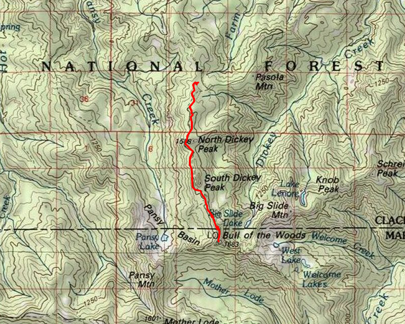
| Location / Trail | Bull of the Woods Trail - 550 |
| Weather | Sunny |
| Hiking Buddies | Thor |
| Start / End | 11:15 AM – 3:00 PM |
| Distance / Elev | 6.7 miles |
I was hoping it would be quiet since it was during the week, however it was not to be. It wasn’t too busy – I met 7 people on the trail – 5 backpackers and 2 hikers.
We headed out a bit later than normal – I slept in a bit and got a few other things done before we left. We got to the trailhead a little after 11:00 – it is a long drive. There was one car in the parking lot when we got there. We got ready and headed down the trail. The beginning of the trail almost looked like someone had taken a weed wacker to both edges of it. It was kind of weird. Nicely groomed, but weird for a trail. A short ways up the trail, we encountered this log that had been cut out recently. The odd part was that it had been cut with a chainsaw, which is supposed to be illegal in the wilderness:

Then there was this log, that was not 50 feet from it that they didn’t cut. I think technically both logs were in the wilderness, but maybe the wilderness sign on this log scared them from cutting it:

We continued down the trail until we got to Terrace Spring – I’m not sure I ever noticed this before – not a terribly active spring, but it did have some water flowing:

We continued down the trail and soon got near the objective for the day – the water source for the lookout. I had two different descriptions of where it was – one from one of the old “trail notes” that I had found at the ranger station, and one from a posting on trailadvocate.org. I had created a waypoint for the point from the trail notes, and printed out the description from the posting. Both were exactly as described. 0.1 miles from the section line crossing and in a small saddle right before the last push up to the lookout – a small trail to the left that went downhill (steeply) to an old cave:

It wasn’t much to look at, and I didn’t really see any water in there, but based on the notes, I’m not sure it had a spring – it sounded like it “collected” water – they had dug it out. It was all filled in. A little bonus was finding some old phone wire next to the cave – it was going up/downhill (east/west):

I had tried to find insulators on the trail – the old maps show it having a phone line, but either the trail has been re-routed, or the phone line didn’t follow the trail.
We went back up to the trail and met a group of three backpackers heading up to the lookout. Very quickly we were at the lookout and we sat down and had some lunch. I talked a bit with them and they were going to head east but they weren’t sure where they were going to spend the night.
The views were pretty good, although some of the mountains were hiding in the clouds. Here is Jefferson and Olallie Butte – with Jefferson hiding in the clouds:

And of course, no trip report to the lookout would be complete without a picture of the lookout:

It is weathering OK, but every time I come up here it seems to be in a little worse shape. It does look like someone might have painted the east side of the lookout though. It is a shame that the Forest Service is OK with just letting it rot in place rather than preserve such an important piece of history – wilderness area or not.
Thor was getting really hot in the sun, so he laid under the lookout for a while. It was amazing how much of a temperature difference there was in the shade and in the sun. We stayed up there for a while, enjoying the view. We then headed back down – we met two more backpackers just below the lookout – they were headed on a big loop down to Elk Lake Creek.
We continued down the trail, making really good time (since it was mostly all downhill). I had thought about heading up to the top of one of the Dickey Peaks, but Thor was pretty tired and it looked rather brushy, so I decided to leave that for another day.
On the way up we found a few snow patches, and Thor played in them a bit, but on the way back we headed over to the small meadow/swamp near the start of the trail and Thor played on this rather large snowbank that was a couple feet deep still:

It was a rather short day in the woods, but a really nice one.