
| Date | 5/1/2021 |
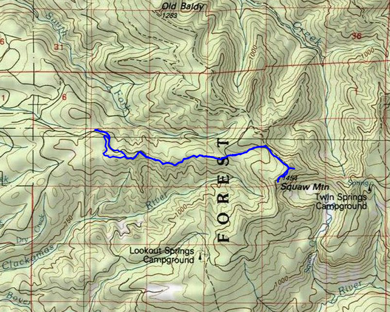
| Location / Trail | Fanton and Old Baldy Trails - 502, 505 |
| Weather | Overcast and misty |
| Hiking Buddies | Kirk, Ollie and Thor |
| Start / End | 9:30 AM – 3:45 PM |
| Distance / Elev | 10 miles 2700 ft elevation |
We started out a bit earlier than normal and made it up to 4614. Kirk thought we could make it up to the corner which isn’t too far from the Old Baldy trail. I didn’t think we would make it that far, but I was hoping we could make it to the midway point where we started a snowshoe a few years ago. We didn’t make it to either as there was still quite a bit of snow on 4614 in places. We ended up stopping at a wide spot and then walking up the road a bit and then heading south thru the woods to meet the trail. The trip up the hill to the trail was kind of steep but not bad walking at all. This is what the forest looked like near where we joined the trail:
![]()
Once on the trail, we headed down. At this point there was essentially no snow on the trail at all, so it was pretty easy going. I forgot to mention that it was VERY foggy when we got there, and that persisted all day long. We got to this first viewpoint, but unfortunately, there would be no view this day – just lots of fog and mist:
![]()
We continued east on the Fanton trail and soon came to this interesting wet area – all melted with a couple of skunk cabbage:
![]()
We continued east and soon got to the mid point where we had hoped to start the trip, which had a fair amount of snow on the old spur. We soldiered on, got to the corner access point and there was even more snow there:

It was at this point where I put on my snowshoes as the snow cover was consistent and getting deeper. Kirk opted to leave his off, but I’m glad I put them on – it made the snow a little easier to navigate.
We continued up and soon got to the old Baldy junction which was barely noticeable with all the snow. We got up to the saddle where the trail splits – one up to Squaw Mountain and the other continuing down to Twin Springs (and the meadows). We stopped and had a quick lunch there. We both got a bit cold at lunch because there was a slight breeze coming thru the saddle which really cooled things off. We packed up and tried to head down the switchbacks but were kind of thwarted. The trail takes a pretty good dip down a steep hillside, but all the snow really obscured where the tread went. We headed down in the direction of where it was supposed to go, but the sidehill was really steep and icy in spots. It was tough going. We got down to the spot about where the first switchback was, and we both decided that we should turn around. We would have had to come back up that slope and we didn’t think we’d have enough time to get to the meadow anyway – so we turned around. This is what the trail in that area looked like – the trail is somewhere on this steep hillside:

Since our primary goal was thwarted by all the snow, we decided to salvage the day and head up to Squaw Mountain. At some point the route of the trail became indistinguishable so we just ended up going cross country, roughly following the route of the trail. There were a few pretty significant snow fields we had to cross over. We finally popped out onto the road leading up to Squaw Mountain which had a lot of snow on it:
![]()
We then got up to the top where the radio repeater is and found it almost buried in snow – we were estimating there was at least 8 feet of snow here:
![]()
We went up to the old lookout location but nothing was visible due to all the snow. I took a picture of Thor and Ollie playing in the snow on the top of Squaw Mountain:
![]()
We spent a few minutes on top – it was actually warmer than it was in the saddle – we were hoping the sun would break thru but it never did. You could tell it was trying, but it was still socked in. After a few minutes, we headed back down, mostly re-tracing our steps out. On the way out, I took a photo of one of the snow fields we had to cross – lots of snow – the wall of snow we had to kick in was probably about 3′ high:
![]()
We took a slightly different route back as we figured on the way in we went too low on the hill. Kirk found an old segment of phone line:
![]()
And one of the most interesting things was that it was actually growing into the tree:
![]()
After seeing that interesting historical artifact, the rest of the trip was pretty uneventful. The trip was mostly downhill. I took off my snowshoes a little earlier than where I put them on – while they help with the snow, they are more difficult to walk in and require more effort.
I guess the only thing that I recall on the return trip was where we were going to head back over to the 4614 road. On the map it looked like a great place was in a flat area shortly before where we would hit the 130 spur. There were TONS of rhodies that we would have to push thru so we ended up heading out to the 130 spur. We thought we could head over to 4614 from there, but the trees were pretty thick, so we ended up just walking the spur out to where it hit 4614. It was slightly longer but much easier I think. We liked walking thru the trees because there was less snow which made for easier walking, but sometimes you have to just go with the flow.
We got back to the truck before our targeted time, but I was surprised to see that no one had attempted to drive up 4614 any farther than we did. I’m guessing it was due to the weather – there weren’t a ton of people out. We packed up and headed out.
While the day turned out differently than expected/planned, it was still a really good day of exploration – I always enjoy the snow (so does Thor). We are hoping that at some point we can attempt this trip and make it down to the meadows. More to come on that.