
| Date | 10/29/2022 |
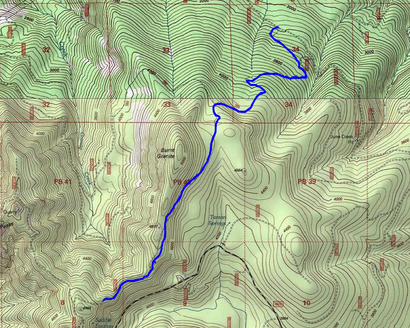
| Location / Trail | Burnt Granite Trail - 595 |
| Weather | Cloudy with some sunbreaks |
| Hiking Buddies | Thor |
| Start / End | 10:40 AM – 2:45 PM |
| Distance / Elev | 8 miles 2200 ft elevation |
Since they closed the north end of 4650, it is a longer drive to get to the trailhead now, having to drive up to 4670 and then back around to 4650. I made pretty good time on the way – I saw quite a few more people than I was expecting – I think hunters are out it force right now.
Once we turned onto the 4650 road, it looked VERY different than it used to – I wondered if they were starting to do the thinning that they had flagged several years ago. At the end of the day, I found out they have started it which is why the road is getting so much more traffic now.
Since they have brushed out the road, it was harder to tell where the trail crossed the road. I contemplated using the “old” access point (using the 820 spur to access the trail), but I decided to take the real trail to see how it has fared over the winters since I saw it last. I think the last time I hiked that area was in 2019. Fortunately, things were in reasonably good shape – a few small trees down (I would have cut them out if I’d brought my saw), but overall it was pretty good. Made good time up to the junction with the trail- and most of that is still in pretty good shape – I’m not sure what it will look like once they come in and do thinning but right now it looks pretty good.
Once we met up with the “old” trail, we continued up. The trail was in pretty good shape, although it felt brushier than it had – I’m guessing because it was pretty wet and all the brush was hanging low. I ended up putting on my rain jacket only because of all the water on the brush – I was getting pretty wet from that. After putting on my rain jacket, we continued up – and up – and up. At one point the sun was out and oyu could see the blue sky – I was not expecting this kind of weather – I was just hoping it wouldn’t rain much – but it was a BEAUTIFUL fall day up there:

And I saw quite a bit of evidence of deer activity on the trail:

We continued up and pretty soon we got to the junction with the trail down to Tarzan Springs – the big old oil can is something new – wonder where someone found that artifact:

After passing that junction we continued up – it was past here that it seemed like the trail got a little better – I wonder if more people did the loop from Rho Ridge down to Tarzan Springs than went down to the river? This is what the trail above Tarzan Springs looked like:

A little farther up the trail we finally got to the first rockslide and then soon to the second one where there was this beautiful view – the Pinheads, Sisi, Olallie and Mt Jefferson:

And all around were absolutely beautiful fall colors on display:

I thought about stopping for lunch in the rockslide since the view was so nice, but decided to continue up. We kept going and got to the big boulder field:

where we thought were old Indian “vision quest” pits – you can see the cairns marking them. One thing that I don’t remember seeing before and was rather stark with the snow was an old phone line in the boulder field:

We stopped here in the boulder field to eat lunch and I brought my drone so I thought that would be a good place to get some nice aerial shots. I ended up not being able to fly it- it appears the batteries were all basically dead and also there was some software issue, so after a few attempts I gave up and put it back in my backpack.
While we were eating lunch I heard something in the distance – it sounded kind of like it was coming from over near Rho Ridge (Mt Lowe maybe?) and at first it almost sounded like voices but later it sounded more like hound dogs on the scent of something. I only heard it a couple of times.
We finished lunch, packed up and continued south – we finally found the 270 spur road and started walking it out – there were a few decent sized trees over it, and then I came to this:

I didn’t really want to navigate all that stuff, and there really wasn’t anything to see out on 6310 so I decided that was our turnaround point. We headed back north. As we were heading north I started hearing the sounds again and it almost sounded like wolves (but it was most likely some hound dogs).
The trip back was quicker than the trip up – I think we only stopped once. We made it back to the truck a little before 3:00. Thor was tired but it was a good trip up an old historic trail.
After we got in the truck I decided to drive down to the end of the road to see if they were indeed thinning. About a mile and a half from the trailhead, on the north side of the powerlines, they had started thinning activity – it was pretty new as I could smell freshly cut wood as I drove thru. Nothing was going on today however:

It was an awesome fall day in the woods!