
| Date | 3/4/2023 |
| Location / Trail | Half Creek Waterfall Fish Creek |
| Weather | Mostly Overcast with a few sunbreaks and snow flurries |
| Hiking Buddies | Kirk, Ollie and Thor |
| Start / End | 9:55 AM – 4:30 PM |
| Distance / Elev | 8.3 miles 1600 ft elevation |
The waterfall was up the Fish Creek drainage off an un-named creek that feeds First Creek. As such, the un-named creek was dubbed “Half Creek”, and the waterfall “Half Creek Waterfall”. We started at our usual time and since it is a short drive quickly got to Fish Creek road, which is closed. They have been working on the campground to remove all the burnt trees and clean things up. They are making good progress:

This is what it looked like a couple of weeks ago (notice the huge pile of wood chips way in the background):

We had to walk up 54 to the spot where Calico road takes off which is almost 2 miles. On the way we noticed a couple of other sets of footprints and some kind of vehicle tracks in the intermittent snow on the road. We also saw animal tracks – some elk and maybe deer – many of the tracks on the road were somewhat degraded due to melting snow.
It wasn’t too long before we got to the “trailhead” and we headed down. We had come down this road on New Years Day this year so we knew it was relatively clear. On New Years Day, we went down Calico to the Rimrock crossing and then back down to the old 54 road along the creek. Today we would stay on Calico until we got to First Creek.
As we walked down the old road/trail, we saw LOTS of sign of mostly Elk. Lots of Elk prints like this one:

As well as lots of elk poop (I call them milk duds – that is what they look like). At one point, Ollie had “done his thing” where he hears/smells/senses something and heads downhill to find it. He started yipping indicating he found something. Kirk walked over to the edge and looked and there were a bunch of Elk. He counted at least 9 and I think they were all bulls. Here is a really poor picture of them (although we could see them a lot better in person):

They didn’t seem too concerned about us, but were walking quickly uphill (not running). They crossed the road ahead of us and continued up the hill. After a bit, Ollie came back, really tired and hot. Kirk noticed some blood and we were guessing one of the elk kicked him – he had some blood around one of his eyes. It didn’t bleed too long – he was lucky. After this interesting encounter, we looked for the spot where they crossed the road – we found it – it wasn’t as worked up as I was expecting it would be.
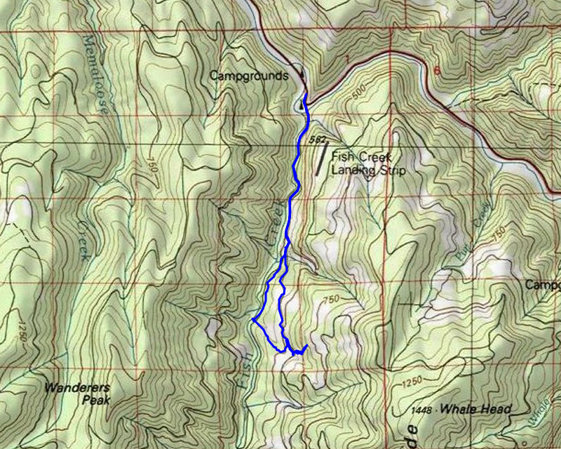
We continued down 5420 and were amazed at how clear it was – just like 54, it really wasn’t in too bad of shape. We were expecting more trees to be down due to the fires. It wasn’t too long before we got to “half creek” which is very close to the First Creek crossing on 5420. We looked uphill trying to determine the best way to get up to the waterfall. We decided to head up the ridge between the two creeks hoping we’d see where we needed to go once we got a bit higher.
The beginning of the ascent wasn’t too bad – not too steep and not too much brush – a little snow, but nothing that was difficult to move in. As we got higher, the hill got steeper and it got more difficult. At one point, I turned around and noticed this great view looking across the Fish Creek drainage over to the old 5430 road:

A little further up the hill, we got glimpses of what we thought was the waterfall amphitheater and pretty soon, we got our first clear view of Half Creek waterfall:

We worked our way closer to it and one one side of the amphitheater there was an “ice avalanche” which was kind of tricky to get over:

We finally made it to the bottom of the waterfall where there is a small cave:

We stopped and ate lunch – this was our view for lunch:

After eating lunch, we explored around a bit. I took this photo looking up at the waterfall which was an interesting perspective:

Next, I pulled out my drone and got it airborne. I was worried I wasn’t going to be able to get a good video of it because it wasn’t getting a GPS lock, but it finally did, and I got this video of the entire waterfall, including what was above it – you can see another smaller waterfall above this one:
After getting the video, we packed up and started to head out – as we were, I caught this picture of a sunbreak peeking over the hill:

Shortly after I got that picture it started snowing – somewhat heavily for a bit. We worked our way slowly back down the hill to 5420. Once we got there, we decided to head up to see First Creek – it wasn’t too exciting but that is the point where we turned around.
On the way back, we decided to take a bit of a loop – Before the fires, one route we did was to walk up Calico, down a short spur and then do a short cross country back down to 54 and then out. We decided to try that today to see how that might work, post fire. We walked back 5420 to the 120 spur, then walked that down a bit. We decided instead of going out to the end of the spur and then looking for a cross country route, we would take a short ridge and then down to 54. It turned out to be a pretty good decision I think.
The 120 spur was in pretty good condition – similar to what both 54 and 5420 are like post fire – not too many downed trees:

At a corner, we headed northwest down the ridge back to 54. This is part of what we encountered when going from 5420-120 down to 54 – some pretty large blowdown:

The last hill down to 54 was littered with big trees that had uprooted – we were guessing they might have uprooted in the windstorm just prior to the Riverside fire since the roots were burned.
We finally made it back down to 54 – at this point it wasn’t much of a road, and was really a trail. On the way down we saw what looked to be maybe an old campsite next to the creek, so we headed over to check it out. It did indeed look like an old campsite and it was a cool “chute” in the creek:

We stopped here for a few minutes and it started lightly raining. We donned our rain jackets since we had been expecting rain/snow pretty much all day. We were fortunate we really didn’t get a whole lot. After stopping for a bit we headed back 54. We made pretty good time. It seemed like the trip down was a lot faster than the trip up. In no time we were back to the current road 54 and we headed down. Most of the snow on that road had melted during the day but there was still a little bit left.
About half way down, we encountered a couple of guys walking up the road – we stopped and chatted for a bit. We found out it was another member on the Trail Advocate website who was out and about exploring things. We talked for quite a while and he asked if we were heading down so he walked with us as we went down to the truck. Once we got there we talked for a while about various things – it started raining more and it was getting pretty cold so we finally said our goodbyes and they went on their way.
It was a great day of exploration – fun, challenging, with a new, interesting destination. The weather was a plus too – we got a little bit of everything but fortunately we didn’t get too much rain/snow. We capped the day with dinner at Time Travelers Brewing – we stepped out of our comfort zone and got the Chef’s special – burnt pork bellies! It was good but somehow for me a burger and fries just hits the spot after hiking!