
| Date | 10/22/2023 |
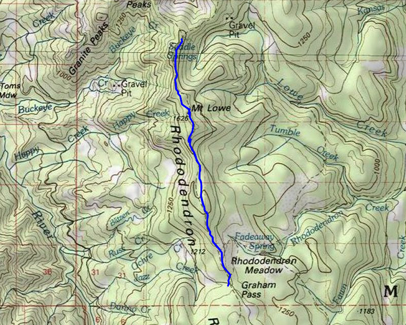
| Location / Trail | Rho Ridge Trail - North End - 564 |
| Weather | Mostly Sunny |
| Hiking Buddies | Jet and Thor |
| Start / End | 11:05 AM – 3:50 PM |
| Distance / Elev | 9.6 miles 1900 ft elevation |
To get there, I decided to take a different way. I noticed that 6310 was the road where the northern trailhead is on, and it appeared to go all the way thru from 63. It was quite a bit shorter in length than going the “normal” way (46 to 4670 to 6310), and it went thru areas I’d never driven, so I thought I’d give it a try. My estimates showed it was about 13 miles from the junction with 63.
We took the turn off 63 and headed up – it passes under the powerlines a few times – I’m guessing this road stays in pretty good shape mostly because of the powerlines. At some point – maybe a bit more than halfway up, I saw this interesting “knob” next to the road. I decided to stop and to up to see what the view looked like:

You could see the top of Mt Hood sticking out from ridge to the north of “the knob”:

The very top of “the knob” was kind of interesting – a loose rocky outcropping:

And I was surprised to see some actual tread – it didn’t really seem to go anywhere, but it was definitely “constructed”:

After exploring “the knob” for a while we piled back into the truck and continued on 6310. I wasn’t sure if we’d be able to make it all the way, but the road was actually pretty good – a few potholes here and there, and in a few spots it got kind of narrow for a bit, but overall it was in really good shape. We got to the old road where Burnt Granite comes out and continued up the road a bit – we then got to the 6310-040 spur which is where the trail actually starts. I might have been able to drive up the road, but we parked in a nice wide spot across the road and then walked up the road. A short distance up you can very clearly see where the tread takes off – I looked a couple of places but since there has been some recent maintenance, it is very clear where the trail starts at the end of the road.
A little ways up the trail we encountered this small meadow:

After that meadow the trail re-enters the woods – a little but farther up the trail looked like this:

When we started I saw relatively fresh lopping next to the trail (cuttings laying on the ground). When we got a bit farther, I noticed there had been very recent (this year, I’m sure) cutting of logs off the trail! (this is a terrible picture, but you can see the cut log)

The trail makes a pretty consistent ascent until it gets to Mt Lowe. One one section, I couldn’t help but take a picture of the beautiful trail bench that is still as good as it was when it was built, probably close to 100 years ago:

A bit farther up, we got to one of the access points on the trail – it is near the 4670-220 spur road – I think the first time I hiked the Mt Lowe trail I came up this road – not sure if it is still open or not. The old trail info sheet for Mt Lowe says that is where the Mt Lowe Trail starts. At the end of the road is this sign showing the trail (although this sign shows Rho Ridge, not Mt Lowe):

We continued south and soon started climbing the switchbacks to Mt Lowe. There is a very short side trail that heads up to the top of Mt Lowe, which was an old lookout site. We stopped and ate some lunch and drank some water. After that, we looked around a bit. Someone has left some artifacts on display in various places:


I also got a peek at Mt Jefferson thru the trees (it looked better in person):

Looking southwest, you could see Schreiner Peak and Bull of the Woods beyond it – We climbed Schreiner earlier this year:

Looking WNW, you can see East Mountain and Fish Creek Divide heading north:

I flew my drone – I wasn’t sure I was going to bring it because it sounded like it might rain – but I’m glad I did. First, I got a great 360 photo shot:
Drone Video:
After taking pictures and flying the drone, we packed up and continued our trip south. At another meadow, we got this great view of Mt Jefferson and Olallie Butte with some of the beautiful fall colors we saw all day long:

And I took a picture of the Forest Service archeologist pink and black flagging – I guess that is because they’ve officially abandoned the trail – and also some more really nice fall colors on display:

A bit further up the trail I couldn’t help notice the very wide corridor that had been cut out for this trail. I’ve noticed this on a lot of older trails – when they used these as the freeways in the woods, they needed a wide corridor for the pack trains. It is cool to still be able to see those corridors:

We continued south on the trail, coming out on 4670 where the trail follows the road for a bit. The trail then re-enters the woods and parallels the road for a bit, finally ending up at the junction of 4670 and 6350 – Graham Pass:

As we were walking over to Graham Pass, I heard a vehicle coming up 6350 – I grabbed the dogs and it was a dump truck. He passed and we went up to the trailhead where Rho Ridge continues south. As we were looking at it, 3 more dump trucks came down the road – on a SATURDAY!:

This was the current trailhead at Graham Pass where the trail continues south:

As we were walking back it was obvious that there has been a LOT of traffic on 6350 – and they’ve cut trees off both sides of the road – I’m not sure what they are doing down there, but it seems to be pretty extensive:

At that point, we had reached our turnaround time – we needed to head back. We turned around and followed the same route back. After you get back into the woods the trail starts its slow climb back up. It didn’t feel that steep on the way down, but going back up was a lot harder. You lose a lot more elevation than you think. I could tell the dogs were getting tired as well, but we all soldiered on. When we got to just below Mt Lowe, I took some more photos of Mt Hood – you get a great view from here and I wanted to experiment a bit with my new phone and its fancy camera.
Here is Mt Hood at a 3x Zoom:

And here is Mt Hood at a 10x Zoom:

I still have a lot to learn about all its features but it seems to work pretty well.
We continued our trip – about 2 miles from the truck I could tell both dogs were really tired. Thor was just following me, and Jet was ahead of me but kept slowing down. We finally made it to the truck a little before our planned time – we made pretty good time on the way back. We piled into the truck and headed out. Right after we started, we encountered another truck (probably hunters) coming the opposite way on 6310 – I had to back up so he could pass. That was the only other vehicle I saw all the way back on 6310.
As we were driving back, I saw this kind of cool view of the clouds hanging over the Clackamas River valley:

As we got lower, we got back into the clouds and once we were back down along the Clackamas it was either REALLY foggy or a bit rainy/misty. Quite a change from the beautiful weather we had all day long up higher.
It was a great day out in the woods – I will need to hike this trail again before 12 year pass!