
| Date | 10/9/2023 |
| Location / Trail | Horseshoe Lake/Ruddy Hill Trails - 712, 714 |
| Weather | overcast |
| Hiking Buddies | Jet and Thor |
| Start / End | 12:15 AM – 2:00 PM |
| Distance / Elev | 3 700 ft elevation |
Today’s trip was planned to be a pretty quick trip – more driving than hiking since Olallie is a bit of a trip. It was forecast to rain, possibly heavily, and also was forecast to have gusty winds. It was pretty gusty at times, but fortunately we escaped almost all of the rain – just a few sprinkles. The plan for the trip was to head up the Horseshoe Saddle (Rondy’s trail) and see if Rondy’s sign survived the fires and then head up to Ruddy hill to see if the old phone box survived the fires. It was just me and the two dogs, who had a good time I think.
After Alyssa arrived with the babies and Jet, I loaded him up and we headed out. It was a late start but since we were doing a short hike I figured it would be fine. It is almost a 2 hour drive to the trailhead – on the way we had a few sprinkles but when we arrived at Olallie it was dry.
We passed the turn to go to the Olallie store and continued down 4220 which was recently reopened after the fires. Along the way, we passed the eastern trailhead for the Red Lake trail, which looked pretty good, other than the burn around it – but the tread appeared to be in good shape – I didn’t go down it, just took a picture:

A little farther, I had a nice view of Olallie Butte looking over the lake:

We continued south on the road – it has definitely been worked on, and is better, however it is still pretty rough in some spots – I don’t think they wanted to make it TOO good. After a while, we arrived at the trailhead and I was surprised to see a newer trailhead sign. My recollection is that this trail used to have a really old trailhead sign – maybe after they installed the Rondy sign they also put up a new trailhead sign?

Just like most campgrounds in the fire areas, there isn’t a whole lot left of the Horseshoe Lake campground:

There is no visible tread at the trailhead due to all the cutting in the campground and all the debris on the ground. Fortunately, I had a track of the trail and that helped us get a start. I knew it kind of followed the north side of Horseshoe Lake, but the track was extremely helpful.
We didn’t get too far when I noticed some prints- at first glace I thought they were horse prints but then I realized they were Elk prints:

The dogs were going kind of crazy smelling all the elk sign. The prints were pretty fresh and I also saw some pretty fresh elk scat.
A little bit further up the trail we came to Rondy’s sign, which survived the fires with little to no damage, which is pretty amazing:

As we continued along the trail it kind of went in and out – this was one of the bad areas where it was tough to see where the trail went – the trail actually goes right thru the middle of the photo – you can see a couple of old cut logs, but the big log down across the trail right next to a cut log:

A little further up the trail there was this short segment of intact tread – that had some amazing fall colors:

We worked our way around the lakes and then headed up the hill. The “in and out” continued up the hill – I’m glad I had the track, as it helped me not get too far off track. We successfully followed it up the hill and to the saddle, where we hit the well used PCT, which was in great shape:

We headed north on the PCT and soon found the junction that went up to Ruddy Hill – I was thinking there was a sign here at one point, but obviously not any longer:

The trail going up to Ruddy Hill is pretty steep, and parts of it were buried under burned bark, which made following it difficult:

I moved a bunch of the burned bark and branches off the tread to help a bit but it still needs a lot more work.
After the really steep section the trail grade eases quite a bit – it still goes up but at a much gentler grade. As we got up to this section, this is what we found – almost impossible to discern the tread route:

Since I had the track, I more or less followed the route until we got up a bit higher at which point I did see some tread. It was about this point where we started to see some small areas that didn’t burn in the fire:

And then we popped out onto the top of Ruddy hill, which is partially burned and partially not:

We headed over to the west side of the hill which was where the old phone box was. I knew it was under a group of trees, so we looked at a couple groups of trees and soon found the remains of the phone box:

This is what it looked like in 2014, the last time I was up here:

And what it looked like in 2007, the first time I saw it:

Although we couldn’t see Mt Jefferson (it was hiding in the clouds), we did get a pretty good view of Pyramid Butte and Dinah-Mo Peak:

Here is a Peakfinder Image showing the detail:

After enjoying the view, we found a bit of shelter (it was kind of gusty), had a quick lunch and then headed down. It hadn’t really rained at all, and I was thinking maybe we could avoid the rain if we hurried back down. I knew the trip down would be faster than the trip up had been.
The trip down was pretty quick and we did escape most of the rain. We had a few slight sprinkles but mostly stayed dry. Once back at the truck, we headed out. I had considered continuing past Horseshoe Lake and going out the Breitenbush road back to 46, but since I was by myself, I thought maybe I should stay on more traveled roads – I wasn’t sure what that road would be like.
We headed back to the Olallie resort – I stopped to take a picture of the lake from next to the store (which was all boarded up for the winter) and then we headed out. As we were driving out 4690, I had to stop and take a picture of some of the beautiful fall colors on display – the hillsides were just on fire with such vibrant colors:

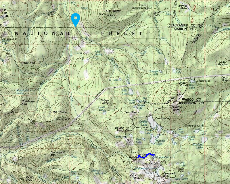
The last thing I wanted to do was to try and find a piece of tread that Donovan had shown me years ago – I’d always wanted to explore it, but never have. I wanted to make sure I remembered where it was, and thank goodness, I did. It is right above the road close to where 4690 meets 46 – I think this might be a piece of the old Cub Creek trail:

After finding that tread and making a waypoint so I have it saved (the reason the map is so small), we headed home. It is a long drive but the dogs just laid down and went to sleep. I’m sure they hiked at least twice as far as I did.
It was a quick, but great day in the woods – I’m glad I was able to get up there before the snow flies. I had not realized that Ruddy hill was so high! (5900′)