
| Date | 8/9/2013 |
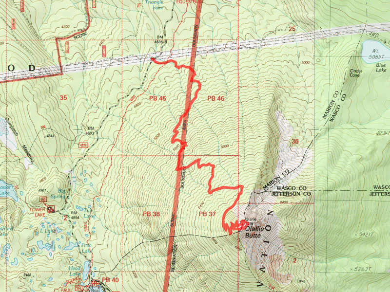
| Location / Trail | Olallie Butte Trail - 720 |
| Weather | Overcast with bits of sunshine - one rumble of thunder on the way down |
| Start / End | 10:20 AM – 3:40 PM |
| Distance / Elev | 7.35 miles |
I had seen photos of the top of Olallie (it looks like it has a hat from a distance) and had wanted to see it for myself. That, coupled with this peak being the highest peak between Mt Hood and Mt Jefferson made it even more attractive. One thing that I wasn’t so sure of – I like more of the “deep woods” trails, and the Olallie area is much sparser and drier. I wasn’t sure I would like the trail itself – maybe the view from the top, but I figured the trail would be kind of “ho hum” at best. Well, I was pleasantly surprised with that as well. This day was giving me all sorts of surprises!
We started out around 10:30am at the southern edge of the powerline clearing, just north of Olallie Lake. There is a powerline road that takes off from here and near the beginning of that powerline road is where the Olallie Butte trail takes off. It was in great shape, with little blowdown. It stays in the trees, and shortly crosses the Pacific Crest Trail, and then continues its rather relentless trek uphill. Since the trail has to gain about 2500′ of elevation in 3.5 miles, it has to be reasonably aggressive. The nice thing was that this trail really was well graded – it pretty much just is continually going up, but almost never at a steep grade. It was much easier than I had expected – especially for all the elevation gain.
The trail continues up through some very nice forest – much larger and greener than I had expected. It passes a few little meadow areas (which I should have gotten photos of). Although the theme of this day would be all about views. Our first glimpse of the views we would be enjoying came on the first rocky opening in the trail, about 2/3rds of the way up the trail. We stopped for a bit to take in these views:

Here is a photos of Kirk (and Bandit) reviewing the map to identify the peaks on the horizon:

And here is a photo of the “lone dog”, Bodie

Although Bodie LOVES to go hiking with me, he is not terribly good around other people or dogs. Kirk has taken Bandit with us on several occasions and he is a great trail companion. I thought (maybe) that if Bodie was not at home he might do better with other people and dogs. Turns out I was partially correct. If I let him off leash he could do his own thing and run away from other dogs – if I left him on the leash he got rather scared and snippy. It worked out OK, but I don’t know if I will take him on another group hike. He tends to do better when it is just me or the family. OK, back to the hike….
After breaking out into the open (pretty much above treeline at this point), and a bit more climbing-getting a little steeper as we approached the “hat” of Olallie. As we finally got on top, this was pretty much the first relic we found:

It was a really big firepit, with some of the wood from the old lookout. The wood from the lookout was scattered all over the top of the butte. It looks like people have used it for various things. I was surprised at how big it is up on top, and also that it isn’t really flat – it has a higher and lower end. The lookout was built on the north end of the butte, on a pile of cinder rocks, but collapsed many years ago – you can still see the remains of the lookout which was very interesting. My recollection was that it collapsed due to snow load one winter and they just left it in place. It shows how slowly things break down at this elevation:

Once we saw the old lookout, we started exploring the rest of the top of the butte. The east side has a pretty dramatic drop off – much different than the west side. There was even still some snow on the northeast corner of the butte, although Kirk said it is a much smaller snowfield than he has seen in previous years:

And then we got our first look at some of the dramatic rock outcroppings on the east side – wow:


Even though it was a bit smoky this day, you could see all the way east from on top – Bend is out there somewhere – you can definitely see the wheat fields of central Oregon:

Walking around to the south side of the butte, you got a GREAT view of Mt Jefferson – this photo doesn’t do it justice – you really felt like you could touch it from up there:

And then looking down on Olallie Lake:

Most of the bushes/trees on top of Olallie were pretty flat. I think it is because of all the snow – they get flattened out every year, so grow out more than up:

Lastly, I will leave you with some of the panoramic views from the trip – they don’t even being to do these views justice:
View from the rockfield about 2/3rd of the way up:

This was a cool one – I wish I could have gotten Mt Hood in the panorama – it is from the old lookout – starting at the south, panning west up to Mt Hood – I couldn’t quite get Mt Hood in the panorama. It was neat being able to look to your left and see Mt Jefferson then look to your right and see Mt Hood:

Lastly, a panorama looking kind of southeast (Mt Jefferson to the right), with Kirk pointing at something:

After eating some lunch and taking in the views one last time, we headed back down. We did a little bit of trail maintenance on the way down, nothing major – just a little brushing and moving logs off the trail. We did hear one burst of thunder on the way down. Thunderstorms were forecast for the evening, and I guess they were correct. The trip down was much less strenuous than the trip up for sure.
A great day – and a surprising hike. I would definitely do this one again. It is all about the views!