
| Date | 11/13/2021 |
| Location / Trail | Skyline Trail segments and West Pinhead Butte |
| Weather | Mostly Sunny |
| Hiking Buddies | Kirk, Ollie and Thor |
| Start / End | 10:40 AM – 4:20 PM |
| Distance / Elev | 7.25 miles 1400 ft elevation |
We headed out a bit early since it is a long drive – we decided to not go to the same spot we went last time – I was concerned it would be REALLY muddy in the “wood chip roads” due to all the rain we had, so we parked at a turnout on 4220 and headed over to the trail (which isn’t too far off the road anyway).
Right next to where we parked there were a bunch of pink ribbons, and then I found this short segment with some older flagging which looked an awful lot like old tread – could this have been an old connector trail to the skyline trail?:

Shortly, we came to the trail which we were on 2 weeks ago. A lot of this is in pretty good shape, other than all of the downed logs:

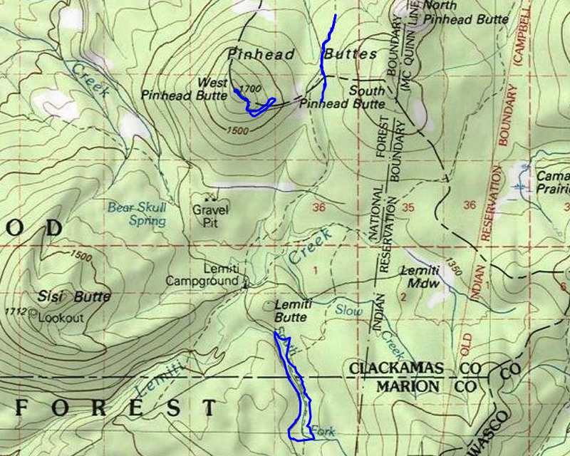
We hiked south, all the way to its junction with an old, closed road east of where 4290 meets 4220. Parts of the trail north of here are rather vague, but we were able to make our way thru it, using blazes and flags and the tracks we had previously. When we got to the old road, we stopped and had lunch. After a quick lunch (the days are short), we headed west back to 4220 (we didn’t want to go back the way we came – it was pretty tough going) and then walked 4220 back to the truck.
Once loaded back up, we headed north to the 4230 road – the plan was to drive as far as we could up 4230 and then walk the rest of the way to the top of West Pinhead Butte. There was a gate on the maps, and I assumed we would get stopped there – it was about a mile and a half to the top from that gate. Fortunately, we were able to drive very close to the top. We looked for the 120 spur to the top but it wasn’t in the place the map showed. It wasn’t far to the top and it was pretty open, so we figured we’d just make our own way to the top. It wasn’t too long before we encountered a road, which was the 120 spur. It wasn’t where the map showed it – at least the spot just above 4230:

We walked the rest of the way up the butte using the road. As we were walking up, Kirk saw North Pinhead Butte – which has an area that looks a lot like line Ruddy Hill – a big red spot (harder to see in this photo – it was much more apparent in person):

When we got to the top of the butte, we were surprised to see the remnants of an old lookout:

This looked to be larger than other lookouts – maybe 20′ square – most seemed to be about 14′ square. The other interesting thing was that there was still a lot of wood up there- like they hadn’t burned it like that had other lookouts – maybe it just collapsed?:

We looked around, I flew my drone and I thought I got video of the view above the trees, however I guess I didn’t hit record and so didn’t get that video.
One of the things that Kirk found below the lookout were 3 garbage pits – or maybe they were the old outhouse – not sure, but they all had old metal in them:

After looking around a bit more, we headed back down. The amazing thing was that if you were so inclined, and brought a chainsaw, I think you could actually drive to the top of West Pinhead Butte – it gets a bit brushy in a few spots, and there is a bit of road washout in a couple of places, but overall the road wasn’t bad. We walked back down the road to see where it intersected the 4230 road – it isn’t where it shows on the map, but it starts about a quarter of a mile downhill from where it shows on the map. This actually makes sense as it would have been too steep if it had been built where the map shows it. We walked back to the truck, loaded up and headed out for the third (and last) segment of the day.
Just down the road a bit from where we were, the Skyline trail crossed the road – I had short segments both north and south of 4230. We decided to head north to see what we could find. The trail in here is actually in pretty good shape, except for a few short areas. We were able to follow it pretty easily. Here are a couple of shots:


Along the way, we found 3 different places that had this weird flagging – at one point we thought it was the trail but soon realized it was not. It was two orange flags with a pink flag in the ground. We couldn’t figure out what it was for:

We continued north and were following trail but it was starting to get late. We got to this interesting rock cairn and decided we should turn around:

We got back to 4230 and headed south for a short ways but it was really starting to get dark so we turned around and headed back. I think we added another mile or 2 to the tracks we have for the Skyline Trail! Had it not gotten dark so early, we could easily have gone farther north or south.
We capped off the day by stopping at Fearless for dinner. A great way to end a great day of exploring.